Aveyron, Occitania, Miscellaneous: Best trails, routes and walks

261 comments

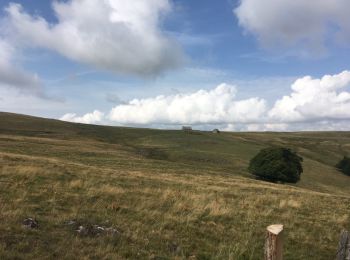
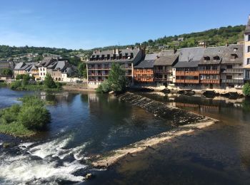
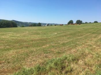
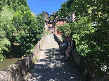
Aveyron: Discover the best trails: . All these trails, routes and outdoor activities are available in our SityTrail applications for smartphones and tablets.


The best trails (117)

Trail Other activity Decazeville - compostelle 2017 mt - Photo
Other activity 214.057
Km

Other activity

Very easy
(5)
Decazeville, Occitania, Aveyron, France
214 km | 295 km-effort
1666h 40min
5977 m
6208 m
No
MAITHE

Trail Other activity Saint-Côme-d'Olt - ggggfff - Photo
Other activity 38.956
Km

Other activity

Very easy
Saint-Côme-d'Olt, Occitania, Aveyron, France
39 km | 68 km-effort
6h 59min
2288 m
1966 m
No
flopey94

Trail Other activity Saint-Chély-d'Aubrac - St Chely d'Aubrac - Les Plagnes - Photo
Other activity 21.516
Km

Other activity

Very easy
Saint-Chély-d'Aubrac, Occitania, Aveyron, France
22 km | 30 km-effort
5h 35min
781 m
300 m
No
jbtregouet

Trail Other activity Campuac - Atlamed campuac - espalion - Photo
Other activity 26.464
Km

Other activity

Very easy
Campuac, Occitania, Aveyron, France
26 km | 35 km-effort
6h 6min
538 m
844 m
No
jbtregouet

Trail Other activity Conques-en-Rouergue - Atlamed Conques - Campuac - Photo
Other activity 22.926
Km

Other activity

Very easy
Conques-en-Rouergue, Occitania, Aveyron, France
23 km | 32 km-effort
6h 11min
783 m
438 m
No
jbtregouet

Trail Other activity Conques-en-Rouergue - Atlamed Conques - Campuac - Photo
Other activity 22.926
Km

Other activity

Very easy
Conques-en-Rouergue, Occitania, Aveyron, France
23 km | 32 km-effort
6h 11min
783 m
438 m
No
jbtregouet

Trail Other activity Decazeville - Atlamed Decazeville - Conques - Photo
Other activity 21.429
Km

Other activity

Very easy
Decazeville, Occitania, Aveyron, France
21 km | 32 km-effort
5h 36min
797 m
712 m
No
jbtregouet

Trail Other activity Espalion - Atlamed Espalion - st Chely d'Aubrac - Photo
Other activity 25.302
Km

Other activity

Very easy
Espalion, Occitania, Aveyron, France
25 km | 37 km-effort
6h 27min
1012 m
546 m
No
jbtregouet

Trail Other activity Mostuéjouls - licous  - Photo
Other activity 10.166
Km

Other activity

Difficult
Mostuéjouls, Occitania, Aveyron, France
10.2 km | 16.7 km-effort
3h 40min
485 m
493 m
Yes
epeteytas

Trail Other activity La Roque-Sainte-Marguerite - feroces20.04.2016 - Photo
Other activity 17.81
Km

Other activity

Very easy
La Roque-Sainte-Marguerite, Occitania, Aveyron, France
17.8 km | 30 km-effort
3h 5min
900 m
899 m
Yes
BZH74

Trail Other activity La Roque-Sainte-Marguerite - feroces20.04.2016 - Photo
Other activity 17.81
Km

Other activity

Very easy
(1)
La Roque-Sainte-Marguerite, Occitania, Aveyron, France
17.8 km | 30 km-effort
3h 5min
900 m
899 m
Yes
BZH74

Trail Other activity Tournemire - tournemire - Photo
Other activity 7.735
Km

Other activity

Very easy
Tournemire, Occitania, Aveyron, France
7.7 km | 11.6 km-effort
1h 42min
293 m
289 m
Yes
carmelocruz

Trail Other activity Saint-Chély-d'Aubrac - vv - Photo
Other activity 17.736
Km

Other activity

Very easy
Saint-Chély-d'Aubrac, Occitania, Aveyron, France
17.7 km | 26 km-effort
Unknown
650 m
402 m
No
flopey94

Trail Other activity Espalion - eeeee - Photo
Other activity 12.566
Km

Other activity

Very easy
Espalion, Occitania, Aveyron, France
12.6 km | 16.6 km-effort
3h 23min
303 m
308 m
No
flopey94

Trail Other activity Espalion - estaing - Photo
Other activity 12.535
Km

Other activity

Very easy
(1)
Espalion, Occitania, Aveyron, France
12.5 km | 16.6 km-effort
3h 23min
303 m
303 m
No
flopey94

Trail Other activity Peyrusse-le-Roc - Peyrusse le Roc  - Photo
Other activity 5.822
Km

Other activity

Very easy
Peyrusse-le-Roc, Occitania, Aveyron, France
5.8 km | 8.3 km-effort
1h 47min
193 m
179 m
Yes
brigittedelasource

• ??

Trail Other activity Villefranche-de-Panat - Villefranche de Panat  - Photo
Other activity 13.083
Km

Other activity

Very easy
Villefranche-de-Panat, Occitania, Aveyron, France
13.1 km | 15.1 km-effort
2h 36min
153 m
152 m
Yes
brigittedelasource

Trail Other activity Thérondels - Therondels à Pierrefort - Photo
Other activity 12.286
Km

Other activity

Medium
Thérondels, Occitania, Aveyron, France
12.3 km | 17.6 km-effort
4h 21min
391 m
414 m
No
paul12

• Un départ à 950 m le passage du pont d estradié à 650 m environ.un parcours en chemin creux ou piste agricole avec un...

Trail Other activity Saint-Izaire - Circuit pédestre du St-Affricain
Other activity 10.003
Km

Other activity

Very easy
Saint-Izaire, Occitania, Aveyron, France
10 km | 14.5 km-effort
Unknown
338 m
338 m
Yes
tbrunet

• Difficulté : Moyenne, Distance : 10 km, Dénivelé : 230 m.Au départ de Saint-Izaire, charmant village dominé par un ch...

Trail Other activity Baraqueville - Baraqueville - Photo
Other activity 3.271
Km

Other activity

Very easy
Baraqueville, Occitania, Aveyron, France
3.3 km | 3.9 km-effort
1h 0min
48 m
48 m
Yes
danou56

20 trails displayed on 117

FREE GPS app for hiking

Logo SityTrail SityTrail

IGN / Geographical institutes

Download SityTrail from the App Store Download SityTrail from Google Play

Logo SityTrail SityTrail World

The world is yours!

Download SityTrail from the App Store Download SityTrail from Google Play Download SityTrail on Huawei AppGallery

Activities

Nearby regions

Close
My subscriptions