Chatte, Isère: Best trails, routes and walks

3 comments

Chatte: Discover the best trails: 11 hiking trails and 3 bike and mountain-bike routes. All these trails, routes and outdoor activities are available in our SityTrail applications for smartphones and tablets.
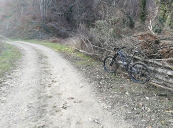

The best trails (14)

Trail Mountain bike Chatte - De Chatte à St Antoine en passant par Chevrière - Photo
Mountain bike 44.14
Km

Mountain bike

Very difficult
(1)
Chatte, Auvergne-Rhône-Alpes, Isère, France
44 km | 60 km-effort
3h 53min
1191 m
1189 m
Yes
gilder89

Trail Road bike Chatte - chatte2 - Photo
Road bike 57.402
Km

Road bike

Very easy
(1)
Chatte, Auvergne-Rhône-Alpes, Isère, France
57 km | 71 km-effort
3h 18min
1020 m
1019 m
Yes
BELLETGE

Trail Mountain bike Chatte - chemin du tram part1 - Photo
Mountain bike 11.367
Km

Mountain bike

Very easy
Chatte, Auvergne-Rhône-Alpes, Isère, France
11.4 km | 14.1 km-effort
1h 16min
208 m
208 m
Yes
Julien Rodriguez

Trail Walking Chatte - CHATTE - Photo
Walking 10.599
Km

Walking

Difficult
Chatte, Auvergne-Rhône-Alpes, Isère, France
10.6 km | 12.1 km-effort
1h 42min
113 m
113 m
Yes
000151.528cee2ba5ea499bb7720e62b4a3eb52.0056

Trail Walking Chatte - Chatte - Photo
Walking 10.155
Km

Walking

Medium
Chatte, Auvergne-Rhône-Alpes, Isère, France
10.2 km | 11.9 km-effort
1h 41min
131 m
133 m
Yes
000151.528cee2ba5ea499bb7720e62b4a3eb52.0056

Trail Walking Chatte - Chatte - Photo
Walking 10.844
Km

Walking

Difficult
Chatte, Auvergne-Rhône-Alpes, Isère, France
10.8 km | 12.2 km-effort
1h 38min
99 m
101 m
Yes
000151.528cee2ba5ea499bb7720e62b4a3eb52.0056

Trail Walking Chatte - Le Tour des Chapelles - Photo
Walking 11.883
Km

Walking

Medium
Chatte, Auvergne-Rhône-Alpes, Isère, France
11.9 km | 16.8 km-effort
3h 50min
368 m
368 m
Yes
neoroll44

• Le Pays de Saint-Marcellin vous offre une escapade champêtre, une promenade entre collines et vallons. Prenez le temp...

Trail Walking Chatte - chatte. les 3 chapelles - Photo
Walking 12.725
Km

Walking

Easy
(1)
Chatte, Auvergne-Rhône-Alpes, Isère, France
12.7 km | 17.4 km-effort
3h 36min
351 m
351 m
Yes
patchil

• Petite randonnée très agréable avec peu de dénivelé. Le parcours est bien balisé et les trois chapelles sont très jol...

Trail Walking Chatte - Chatte - Photo
Walking 12.735
Km

Walking

Difficult
Chatte, Auvergne-Rhône-Alpes, Isère, France
12.7 km | 17.4 km-effort
5h 4min
346 m
347 m
Yes
Jean Claude Marchand

Trail Walking Chatte - Chatte - Photo
Walking 10.438
Km

Walking

Difficult
Chatte, Auvergne-Rhône-Alpes, Isère, France
10.4 km | 13.4 km-effort
1h 47min
218 m
221 m
Yes
000151.528cee2ba5ea499bb7720e62b4a3eb52.0056

Trail Walking Chatte - chatte - Photo
Walking 15.472
Km

Walking

Very difficult
Chatte, Auvergne-Rhône-Alpes, Isère, France
15.5 km | 20 km-effort
4h 22min
376 m
375 m
Yes
repiton

Trail Walking Chatte - chatte circuit des chapelles - Photo
Walking 14.528
Km

Walking

Very easy
Chatte, Auvergne-Rhône-Alpes, Isère, France
14.5 km | 19.8 km-effort
5h 18min
393 m
395 m
No
Gilbertbancilhon

Trail Walking Chatte - chatte - Photo
Walking 5.987
Km

Walking

Very easy
Chatte, Auvergne-Rhône-Alpes, Isère, France
6 km | 6.8 km-effort
1h 27min
62 m
60 m
No
Randosdeguy

Trail Walking Chatte - Circuit des chapelles - Photo
Walking 12.728
Km

Walking

Very easy
Chatte, Auvergne-Rhône-Alpes, Isère, France
12.7 km | 17.3 km-effort
4h 10min
343 m
343 m
Yes
CathyBB26

14 trails displayed on 14

FREE GPS app for hiking

Logo SityTrail SityTrail

IGN / Geographical institutes

Download SityTrail from the App Store Download SityTrail from Google Play

Logo SityTrail SityTrail World

The world is yours!

Download SityTrail from the App Store Download SityTrail from Google Play Download SityTrail on Huawei AppGallery

Activities

Close
My subscriptions