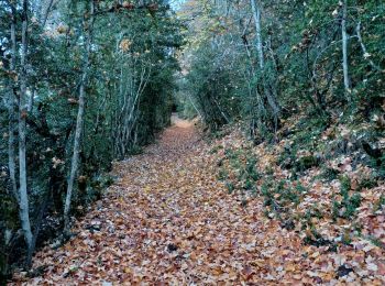
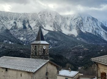
Blégiers, Prads-Haute-Bléone: Best trails, routes and walks

2 comments

Blégiers: Discover the best trails: 16 hiking trails. All these trails, routes and outdoor activities are available in our SityTrail applications for smartphones and tablets.


The best trails (16)

Trail Walking Prads-Haute-Bléone - Sentier MARCEL -Boucle 6.4Km) - Photo
Walking 6.155
Km

Walking

Medium
(1)
Prads-Haute-Bléone, Provence-Alpes-Côte d'Azur, Alpes-de-Haute-Provence, France
6.2 km | 9.6 km-effort
2h 4min
260 m
260 m
Yes
neitag61

Trail Walking Prads-Haute-Bléone - LA JAVIE , refuge de la Ceriege . S Pierre o n  - Photo
Walking 12.342
Km

Walking

Medium
Prads-Haute-Bléone, Provence-Alpes-Côte d'Azur, Alpes-de-Haute-Provence, France
12.3 km | 21 km-effort
4h 41min
615 m
615 m
Yes
RobinMicheline

Trail Walking Prads-Haute-Bléone - Prads-Haute-Bléone heyre chavailles 17k 950m - Photo
Walking 15.506
Km

Walking

Medium
Prads-Haute-Bléone, Provence-Alpes-Côte d'Azur, Alpes-de-Haute-Provence, France
15.5 km | 28 km-effort
7h 14min
909 m
912 m
Yes
Danielba

Trail Walking Prads-Haute-Bléone - Sentier Marcel 2 - Photo
Walking 11.696
Km

Walking

Medium
(1)
Prads-Haute-Bléone, Provence-Alpes-Côte d'Azur, Alpes-de-Haute-Provence, France
11.7 km | 22 km-effort
4h 38min
754 m
778 m
Yes
DC2019

Trail Walking Prads-Haute-Bléone - Rando946 - Photo
Walking 22.7
Km

Walking

Very difficult
Prads-Haute-Bléone, Provence-Alpes-Côte d'Azur, Alpes-de-Haute-Provence, France
23 km | 41 km-effort
7h 24min
1383 m
1381 m
Yes
Escondido

Trail Walking Prads-Haute-Bléone - Heyre et environs - Photo
Walking 10.359
Km

Walking

Difficult
Prads-Haute-Bléone, Provence-Alpes-Côte d'Azur, Alpes-de-Haute-Provence, France
10.4 km | 19.9 km-effort
4h 10min
714 m
712 m
Yes
y39c43l

Trail Walking Prads-Haute-Bléone - Sentier Marcel + variante la Basse - Photo
Walking 9.661
Km

Walking

Difficult
Prads-Haute-Bléone, Provence-Alpes-Côte d'Azur, Alpes-de-Haute-Provence, France
9.7 km | 19.5 km-effort
3h 59min
737 m
730 m
Yes
DC2019

Trail Walking Prads-Haute-Bléone - heyres-chavailles - Photo
Walking 14.378
Km

Walking

Medium
Prads-Haute-Bléone, Provence-Alpes-Côte d'Azur, Alpes-de-Haute-Provence, France
14.4 km | 27 km-effort
6h 9min
952 m
950 m
Yes
gerin

Trail Walking Prads-Haute-Bléone - vhkliy - Photo
Walking 9.625
Km

Walking

Difficult
Prads-Haute-Bléone, Provence-Alpes-Côte d'Azur, Alpes-de-Haute-Provence, France
9.6 km | 18.2 km-effort
3h 16min
645 m
644 m
Yes
Clo0413

Trail Walking Prads-Haute-Bléone - La Colle ( Heyre) départ Blégiers - Photo
Walking 10.148
Km

Walking

Medium
Prads-Haute-Bléone, Provence-Alpes-Côte d'Azur, Alpes-de-Haute-Provence, France
10.1 km | 18.8 km-effort
3h 27min
651 m
648 m
Yes
Clo0413

Trail Walking Prads-Haute-Bléone - 2021-10-28-Heyre vallon Pas du Loup NV-MNT - Photo
Walking 10.421
Km

Walking

Medium
Prads-Haute-Bléone, Provence-Alpes-Côte d'Azur, Alpes-de-Haute-Provence, France
10.4 km | 19.8 km-effort
4h 29min
700 m
699 m
Yes
Clo0413

Trail Walking Prads-Haute-Bléone - montagne de Carton - Photo
Walking 11.58
Km

Walking

Medium
Prads-Haute-Bléone, Provence-Alpes-Côte d'Azur, Alpes-de-Haute-Provence, France
11.6 km | 24 km-effort
6h 37min
931 m
928 m
Yes
radisnoir

Trail Walking Prads-Haute-Bléone - mourrez frey - Photo
Walking 13.392
Km

Walking

Very easy
Prads-Haute-Bléone, Provence-Alpes-Côte d'Azur, Alpes-de-Haute-Provence, France
13.4 km | 29 km-effort
7h 33min
1187 m
1187 m
Yes
moreauchristian

Trail Walking Prads-Haute-Bléone - Sentier Marcel  + - Photo
Walking 10.359
Km

Walking

Difficult
Prads-Haute-Bléone, Provence-Alpes-Côte d'Azur, Alpes-de-Haute-Provence, France
10.4 km | 19.9 km-effort
4h 6min
714 m
712 m
Yes
DC2019

Trail Walking Prads-Haute-Bléone - Santier Marcel - Photo
Walking 6.156
Km

Walking

Easy
Prads-Haute-Bléone, Provence-Alpes-Côte d'Azur, Alpes-de-Haute-Provence, France
6.2 km | 9.6 km-effort
2h 1min
260 m
260 m
Yes
DC2019

Trail Walking Prads-Haute-Bléone - marcel1 - Photo
Walking 2.751
Km

Walking

Very easy
Prads-Haute-Bléone, Provence-Alpes-Côte d'Azur, Alpes-de-Haute-Provence, France
2.8 km | 5.2 km-effort
1h 15min
231 m
28 m
No
DC2019

16 trails displayed on 16

FREE GPS app for hiking

Logo SityTrail SityTrail

IGN / Geographical institutes

Download SityTrail from the App Store Download SityTrail from Google Play

Logo SityTrail SityTrail World

The world is yours!

Download SityTrail from the App Store Download SityTrail from Google Play Download SityTrail on Huawei AppGallery

Activities

Close
My subscriptions