Point of interest Baelen - Trou Malbrouk - Photo

Trou Malbrouk

Description

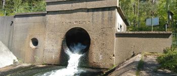
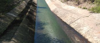
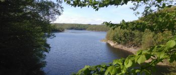
Ce tunnel, construit de 1951 à 1953, a pour but d'augmenter la capacité du bassin versant (une portion de territoire délimitée par des lignes de crête et dont les eaux alimentent un exutoire commun : cours d'eau, lac, etc.) du lac de la Gileppe en captant les eaux de la Soor qui coule à 2,5 kilomètres de là. Sa dénivelée est d’un peu plus de 50 mètres.

Photos

Trou Malbrouk can be discovered in the following trails...

Randonnez sur et autour des GR ® wallons (Sentiers de Grande Randonnée). PRO

© OpenStreetMap contributors

Positioning

Country:
Belgium
Region :
Wallonia
Department/Province :
Liège
Municipality :
Baelen
Location:
Unknown
Creation date :
2022-05-12 07:19:01.038
Updated on
2022-05-12 07:19:01.038

(0 Reviews)


Points of interest nearby

Point of interest Baelen - Point 9 - Photo
didier.cavillot
BAELEN 
Point of interest Baelen - Point 8 - Photo
didier.cavillot
BAELEN 
Point of interest Baelen - Point 10 - Photo
didier.cavillot
BAELEN 
Point of interest Baelen - Point 7 - Photo
didier.cavillot
BAELEN 
Point of interest Baelen - Lac de la Gileppe - Photo
Aqualis
Point of interest Baelen - Point 5 - Photo
didier.cavillot
BAELEN 
Point of interest Baelen - Point 4 - Photo
didier.cavillot
BAELEN 
Point of interest Jalhay - Point 2 - Photo
didier.cavillot
JALHAY 


Close
My subscriptions