Trail Mountain bike Gigors-et-Lozeron - St Supière et Savel à Gigors et Lozeron - Photo

St Supière et Savel à Gigors et Lozeron

 tracegps
tracegps

User

© OpenStreetMap contributors
Length
Length
11.2 km
Max alt
Max alt
871 m
Uphill gradient
Uphill gradient
505 m
Km-Effort
Km-Effort  
17.9 km
Min alt
Min alt
432 m
Downhill gradient
Downhill gradient
509 m
Boucle
Boucle
Yes
Creation date :
2014-12-10 00:00:00.0
Updated on :
2014-12-10 00:00:00.0

(0 Reviews)

Mountain bike
Mountain bike
2h30
Difficulty : Very difficult

Scan this QR Code to open this trail in the SityTrail application

FREE GPS app for hiking

Logo SityTrail SityTrail

IGN / Geographical institutes

Download SityTrail from the App Store Download SityTrail from Google Play

Logo SityTrail SityTrail World

The world is yours!

Download SityTrail from the App Store Download SityTrail from Google Play Download SityTrail on Huawei AppGallery

About

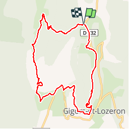
Trail Mountain bike of 11.2 km to be discovered at Auvergne-Rhône-Alpes, Drôme, Gigors-et-Lozeron. This trail is proposed by tracegps.

Description

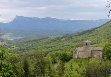
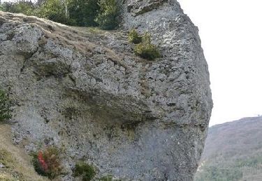
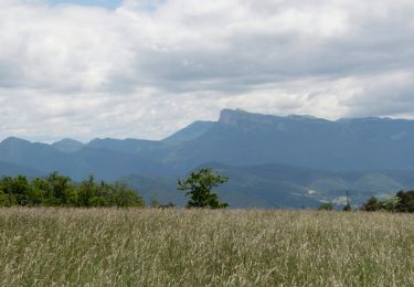
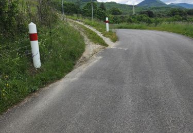
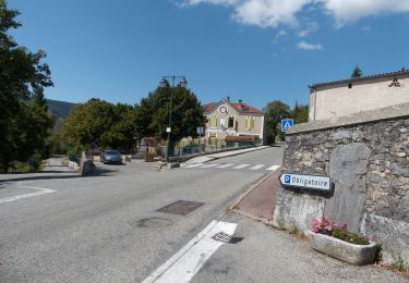
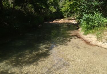
Départ de la rando au-dessus de Gigors, au domaine de Sagnol. Une balade variée, du rocher St Supière avec ses vaches highland aux ruines du Savel en passant par Gigors.

Elevation profile

Photos

Positioning

Country:
France
Region :
Auvergne-Rhône-Alpes
Department/Province :
Drôme
Municipality :
Gigors-et-Lozeron
Location:
Unknown
Start:(UTM)
666361 ; 4964478 (31T) N.

Trails nearby

Trail Walking Gigors-et-Lozeron - Gigors - Saint-Supière - Photo
Walking
Philindy26

Walking

Medium
(1)
Gigors-et-Lozeron, Auvergne-Rhône-Alpes, Drôme, France
11 km | 18.1 km-effort
4h 0min
Yes
Trail Walking Gigors-et-Lozeron - St Supière et Savel à Gigors et Lozeron - Photo
Walking
tracegps

Walking

Difficult
(1)
Gigors-et-Lozeron, Auvergne-Rhône-Alpes, Drôme, France
11.2 km | 17.9 km-effort
4h 0min
Yes
Trail Walking La Baume-Cornillane - Pas du Pont - Pas de la Croix - Pas du Buis - Photo
Walking
patbt

Walking

Medium
(2)
La Baume-Cornillane, Auvergne-Rhône-Alpes, Drôme, France
10.3 km | 18 km-effort
2h 52min
Yes
Trail Walking Beaufort-sur-Gervanne - Beaufort St Pancrace 17km - Photo
Walking
GUIDE
thonyc

Walking

Medium
(1)
Beaufort-sur-Gervanne, Auvergne-Rhône-Alpes, Drôme, France
15 km | 21 km-effort
5h 0min
Yes
Trail Walking La Baume-Cornillane - pas du pont - Photo
Walking
jojomarette

Walking

Easy
(1)
La Baume-Cornillane, Auvergne-Rhône-Alpes, Drôme, France
6.9 km | 9.8 km-effort
3h 22min
Yes
Trail Walking Beaufort-sur-Gervanne - Beaufort - Gigors - Lozeron - Photo
Walking
Philindy26

Walking

Medium
Beaufort-sur-Gervanne, Auvergne-Rhône-Alpes, Drôme, France
18.9 km | 28 km-effort
5h 0min
Yes
Trail Walking Beaufort-sur-Gervanne - BEAUFORT ET GERVANNE - Photo
Walking
Fanchon_24

Walking

Easy
Beaufort-sur-Gervanne, Auvergne-Rhône-Alpes, Drôme, France
36 km | 42 km-effort
4h 8min
No
Trail Walking Plan-de-Baix - Canyon des Gueulards - Plateau du Vellan  - Photo
Walking
Philindy26

Walking

Medium
Plan-de-Baix, Auvergne-Rhône-Alpes, Drôme, France
18.7 km | 28 km-effort
4h 55min
Yes
Trail Walking Beaufort-sur-Gervanne - 26 gervanne druise plan de baix - Photo
Walking
randodyssée

Walking

Medium
Beaufort-sur-Gervanne, Auvergne-Rhône-Alpes, Drôme, France
16.8 km | 23 km-effort
7h 57min
Yes


Close
My subscriptions