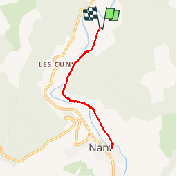
12.4 km | 20 km-effort
Nant
tracegps
User
Length
6.6 km
Max alt
521 m
Uphill gradient
105 m
Km-Effort
8 km
Min alt
469 m
Downhill gradient
105 m
Boucle
Yes
Creation date :
2014-12-10 00:00:00.0
Updated on :
2014-12-10 00:00:00.0
2h00
Difficulty : Easy
FREE GPS app for hiking
About
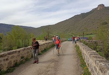
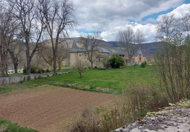
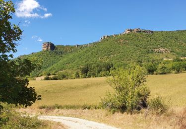
Trail Walking of 6.6 km to be discovered at Occitania, Aveyron, Nant. This trail is proposed by tracegps.
Description
Petite randonnée au départ du camping Val de Cantobre (à conseiller) qui vous emmène au fil de l'eau au village de Nant (très typique de la région).
Positioning
Country:
France
Region :
Occitania
Department/Province :
Aveyron
Municipality :
Nant
Location:
Unknown
Start:(Dec)
Start:(UTM)
524193 ; 4876774 (31T) N.
Comments
Trails nearby
Nant Cantobre Nant
Walking
Medium
Nant,
Occitania,
Aveyron,
France
15.3 km | 23 km-effort
7h 1min
Yes
Le roc nantais
Walking
Medium
Saint-Jean-du-Bruel,
Occitania,
Aveyron,
France
22 km | 32 km-effort
7h 7min
Yes
ST JEAN DE BRUEL CAUSSES BEGON
Walking
Medium
Saint-Jean-du-Bruel,
Occitania,
Aveyron,
France
13.9 km | 20 km-effort
4h 32min
Yes
ST JEAN DE BRUEL CHATEAU D ALGUE
Walking
Medium
Saint-Jean-du-Bruel,
Occitania,
Aveyron,
France
10.3 km | 15.1 km-effort
3h 28min
Yes
Montredon
Walking
Easy
(1)
La Roque-Sainte-Marguerite,
Occitania,
Aveyron,
France
9.6 km | 11.5 km-effort
2h 13min
Yes
Cantobre 31-08-21
Walking
Medium
Nant,
Occitania,
Aveyron,
France
15.5 km | 23 km-effort
4h 14min
Yes
de nant à cantobre
Walking
Medium
Nant,
Occitania,
Aveyron,
France
21 km | 32 km-effort
7h 31min
Yes