Trail Walking Villy - Le Chemin du Pays d'Yvois - Photo

Le Chemin du Pays d'Yvois

 tracegps
tracegps

User

© OpenStreetMap contributors
Length
Length
8.9 km
Max alt
Max alt
210 m
Uphill gradient
Uphill gradient
85 m
Km-Effort
Km-Effort  
10 km
Min alt
Min alt
160 m
Downhill gradient
Downhill gradient
85 m
Boucle
Boucle
Yes
Creation date :
2014-12-10 00:00:00.0
Updated on :
2014-12-10 00:00:00.0

(0 Reviews)

Walking
Walking
2h00
Difficulty : Medium

Scan this QR Code to open this trail in the SityTrail application

FREE GPS app for hiking

Logo SityTrail SityTrail

IGN / Geographical institutes

Download SityTrail from the App Store Download SityTrail from Google Play

Logo SityTrail SityTrail World

The world is yours!

Download SityTrail from the App Store Download SityTrail from Google Play Download SityTrail on Huawei AppGallery

About

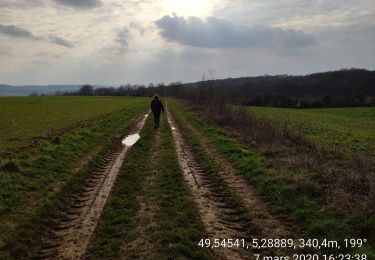
Trail Walking of 8.9 km to be discovered at Grand Est, Ardennes, Villy. This trail is proposed by tracegps.

Description

Les Randonnées Thématiques du Comité Régional du Tourisme de Champagne-Ardenne Le Chemin du Pays d’Yvois La vallée de la Chiers est dominée par des coteaux calmes et enherbés. Derrière ce calme apparent se cachent des ouvrages de la ligne Maginot, théâtres de violents combats en mai 1940. À l’issue de la randonnée, il vous sera possible de découvrir cette histoire par une visite à 35m sous terre.

Elevation profile

Photos

Positioning

Country:
France
Region :
Grand Est
Department/Province :
Ardennes
Municipality :
Villy
Location:
Unknown
Start:(UTM)
661296 ; 5494786 (31U) N.

Trails nearby

Trail Walking Bièvres - Bièvres France - Photo
Walking
patrismichel

Walking

Very easy
Bièvres, Grand Est, Ardennes, France
9.8 km | 13.6 km-effort
2h 40min
Yes
Trail Walking Bièvres - saint walfroy - Photo
Walking
jcb48

Walking

Easy
Bièvres, Grand Est, Ardennes, France
3.7 km | 4.3 km-effort
1h 18min
Yes
Trail Walking Bièvres - chauvancy - Photo
Walking
Claude Luchetta

Walking

Medium
Bièvres, Grand Est, Ardennes, France
8.5 km | 10 km-effort
2h 2min
No
Trail Walking Margut - 08-autour-de-St-Walfroy-3.4km - Photo
Walking
SyMA

Walking

Easy
Margut, Grand Est, Ardennes, France
3.4 km | 4 km-effort
59min
Yes
Trail Walking Auflance - Auflance-Puilly 2020 - Photo
Walking
fra_depoorter

Walking

Easy
Auflance, Grand Est, Ardennes, France
9.7 km | 11.9 km-effort
2h 6min
Yes
Trail Walking Bièvres - Margut 16-02-20 - Photo
Walking
patdecosnes

Walking

Medium
(1)
Bièvres, Grand Est, Ardennes, France
15.1 km | 19.1 km-effort
3h 15min
Yes
Trail Nordic walking Margut - ermitage st walfroy - Photo
Nordic walking
Bgallez

Nordic walking

Very easy
Margut, Grand Est, Ardennes, France
7.6 km | 11.8 km-effort
3h 32min
Yes
Trail Walking Bièvres - St-Walfroy - Bievres - chapelle St-Donat et retour par le Chemin balisé Compostelle - Photo
Walking
Koa1a

Walking

Medium
Bièvres, Grand Est, Ardennes, France
14.2 km | 18.4 km-effort
3h 30min
Yes
Trail Walking Margut - St Walfroy 20-02-22 - Photo
Walking
patdecosnes

Walking

Medium
Margut, Grand Est, Ardennes, France
13.7 km | 18.2 km-effort
2h 57min
Yes


Close
My subscriptions