Trail Walking Gondecourt - Circuit des 11 clochers (Gondecourt) - Photo

Circuit des 11 clochers (Gondecourt)

 tracegps
tracegps

User

© OpenStreetMap contributors
Length
Length
15.3 km
Max alt
Max alt
30 m
Uphill gradient
Uphill gradient
52 m
Km-Effort
Km-Effort  
16 km
Min alt
Min alt
17 m
Downhill gradient
Downhill gradient
52 m
Boucle
Boucle
Yes
Creation date :
2014-12-10 00:00:00.0
Updated on :
2014-12-10 00:00:00.0

(1 Reviews)

Walking
Walking
3h49
Difficulty : Difficult

Scan this QR Code to open this trail in the SityTrail application

FREE GPS app for hiking

Logo SityTrail SityTrail

IGN / Geographical institutes

Download SityTrail from the App Store Download SityTrail from Google Play

Logo SityTrail SityTrail World

The world is yours!

Download SityTrail from the App Store Download SityTrail from Google Play Download SityTrail on Huawei AppGallery

About

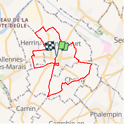
Trail Walking of 15.3 km to be discovered at Hauts-de-France, Nord, Gondecourt. This trail is proposed by tracegps.

Description

Départ de l’église de Gondecourt. Circuit de découverte de la campagne et des villages du Carembault dont on peut apercevoir par temps clair onze clochers. Retrouvez cette randonnée sur le site du Comité Départemental du Tourisme du Nord. Ce circuit a été numérisé par les randonneurs du CODEPEM.
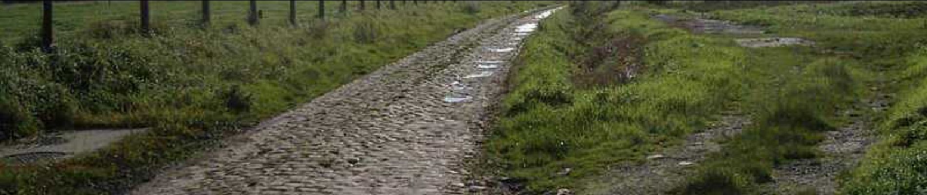
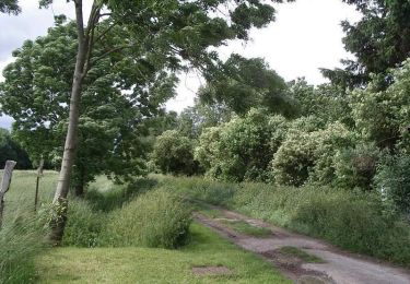
Elevation profile

Photos

Positioning

Country:
France
Region :
Hauts-de-France
Department/Province :
Nord
Municipality :
Gondecourt
Location:
Unknown
Start:(UTM)
498798 ; 5599033 (31U) N.

Comments

Please log in to post a review or rate the element


beaucoup de route en macadam balisage moyen


Trails nearby

Trail Walking Wattignies - Autour des champs captants (Wattignies) - Photo
Walking
tracegps

Walking

Medium
(1)
Wattignies, Hauts-de-France, Nord, France
12.2 km | 13.1 km-effort
3h 15min
Yes
Trail Walking Herrin - Circuit des Naviettes - Herrin - Photo
Walking
tracegps

Walking

Easy
(1)
Herrin, Hauts-de-France, Nord, France
5.7 km | 6 km-effort
1h 30min
Yes
Trail Walking Santes - santes - Photo
Walking
phil.monier

Walking

Very easy
(1)
Santes, Hauts-de-France, Nord, France
4.6 km | 5.1 km-effort
1h 7min
No
Trail Walking Seclin - seclin bis 12,5 km - Photo
Walking
GUIDE
rvapeldo

Walking

Very easy
Seclin, Hauts-de-France, Nord, France
12.7 km | 13.5 km-effort
3h 47min
Yes
Trail Mountain bike Phalempin - export - Photo
Mountain bike
jcn59133

Mountain bike

Medium
(1)
Phalempin, Hauts-de-France, Nord, France
55 km | 61 km-effort
Unknown
Yes
Trail Walking Camphin-en-Carembault - De Camphin-en-Carembault à la tour de l''Horloge - Photo
Walking
tracegps

Walking

Medium
Camphin-en-Carembault, Hauts-de-France, Nord, France
13 km | 14.5 km-effort
3h 25min
Yes
Trail Walking Houplin-Ancoisne - Santes : chaîne de vie - Photo
Walking

Walking

Very easy
Houplin-Ancoisne, Hauts-de-France, Nord, France
5.5 km | 5.9 km-effort
Unknown
Yes
Trail Equestrian La Neuville - Balade équestre en forêt de Phalempin - Photo
Equestrian
tracegps

Equestrian

Difficult
La Neuville, Hauts-de-France, Nord, France
14.7 km | 16.4 km-effort
2h 30min
Yes
Trail Walking La Neuville - Balade équestre en forêt de Phalempin - Photo
Walking
tracegps

Walking

Difficult
La Neuville, Hauts-de-France, Nord, France
14.7 km | 16.4 km-effort
3h 45min
Yes


Close
My subscriptions