Trail Walking Fleurance - Balade tout autour de Fleurance - Photo

Balade tout autour de Fleurance

 tracegps
tracegps

User

© OpenStreetMap contributors
Length
Length
14 km
Max alt
Max alt
120 m
Uphill gradient
Uphill gradient
108 m
Km-Effort
Km-Effort  
15.4 km
Min alt
Min alt
92 m
Downhill gradient
Downhill gradient
106 m
Boucle
Boucle
Yes
Creation date :
2014-12-10 00:00:00.0
Updated on :
2014-12-10 00:00:00.0

(0 Reviews)

Walking
Walking
3h30
Difficulty : Medium

Scan this QR Code to open this trail in the SityTrail application

FREE GPS app for hiking

Logo SityTrail SityTrail

IGN / Geographical institutes

Download SityTrail from the App Store Download SityTrail from Google Play

Logo SityTrail SityTrail World

The world is yours!

Download SityTrail from the App Store Download SityTrail from Google Play Download SityTrail on Huawei AppGallery

About

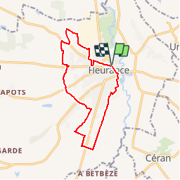
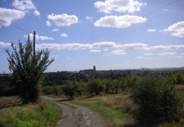
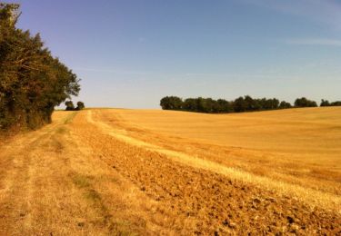
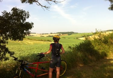
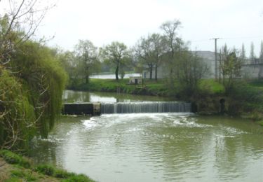
Trail Walking of 14 km to be discovered at Occitania, Gers, Fleurance. This trail is proposed by tracegps.

Description

Balade tout autour de Fleurance Départ du Moulin du Roy. A voir la Bastide de Fleurance. Circuit numérisé par la Communauté de Communes de la Lomagne Gersoise.

Elevation profile

Photos

Positioning

Country:
France
Region :
Occitania
Department/Province :
Gers
Municipality :
Fleurance
Location:
Unknown
Start:(Dec)
Start:(UTM)
312384 ; 4857932 (31T) N.

Trails nearby

Trail Mountain bike Fleurance - GRP Coeur de Gascogne (en plusieurs jours...) - Photo
Mountain bike
tracegps

Mountain bike

Very difficult
Fleurance, Occitania, Gers, France
155 km | 195 km-effort
12h 0min
Yes
Trail Mountain bike Fleurance - De Fleurance à Gavarret - Photo
Mountain bike
tracegps

Mountain bike

Medium
Fleurance, Occitania, Gers, France
23 km | 27 km-effort
1h 30min
Yes
Trail Mountain bike Fleurance - Circuit sud-ouest de Fleurance - Photo
Mountain bike
tracegps

Mountain bike

Medium
Fleurance, Occitania, Gers, France
43 km | 50 km-effort
2h 30min
Yes
Trail Mountain bike Fleurance - Les coteaux ouest de Fleurance - Photo
Mountain bike
tracegps

Mountain bike

Difficult
Fleurance, Occitania, Gers, France
46 km | 56 km-effort
3h 30min
Yes
Trail Walking Fleurance - Quand on marchait 8,5 km sur les chemins... - Fleurance - Photo
Walking
tracegps

Walking

Medium
Fleurance, Occitania, Gers, France
8.6 km | 10.2 km-effort
2h 10min
Yes
Trail Walking Fleurance - Quand on marchait 6 km sur les chemins... - Fleurance - Photo
Walking
tracegps

Walking

Easy
Fleurance, Occitania, Gers, France
6.6 km | 7.8 km-effort
1h 30min
Yes
Trail Walking Fleurance - Quand on marchait 4 km sur les chemins... - Fleurance - Photo
Walking
tracegps

Walking

Easy
Fleurance, Occitania, Gers, France
4.4 km | 5.2 km-effort
1h 0min
Yes
Trail Walking Fleurance - Sur les traces des remparts - Fleurance - Photo
Walking
tracegps

Walking

Medium
Fleurance, Occitania, Gers, France
15.8 km | 17.8 km-effort
4h 0min
Yes
Trail Walking Fleurance - Le chemin du pigeonnier - Fleurance - Photo
Walking
tracegps

Walking

Medium
Fleurance, Occitania, Gers, France
9.8 km | 10.8 km-effort
2h 30min
Yes


Close
My subscriptions