


Tour de la Pierre André

trailer.nono
User
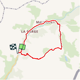

Length
14.5 km

Max alt
2682 m

Uphill gradient
995 m
Km-Effort
28 km

Min alt
1725 m

Downhill gradient
994 m
Boucle
Yes
Creation date :
2019-08-06 08:16:07.872
Updated on :
2019-08-06 18:47:27.651
4h03
Difficulty : Very easy

FREE GPS app for hiking
 SityTrail
IGN / Geographical institutes
SityTrail Plus
The world is yours!
About
Trail Walking of 14.5 km to be discovered at Provence-Alpes-Côte d'Azur, Alpes-de-Haute-Provence, Saint-Paul-sur-Ubaye. This trail is proposed by trailer.nono.
Positioning
Country:
France
Region :
Provence-Alpes-Côte d'Azur
Department/Province :
Alpes-de-Haute-Provence
Municipality :
Saint-Paul-sur-Ubaye
Location:
Unknown
Start:(Dec)
Start:(UTM)
326338 ; 4937303 (32T) N.
Comments