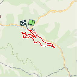
4.4 km | 7.1 km-effort
Boucle de Louch
Renefrt
User
Length
12.8 km
Max alt
1219 m
Uphill gradient
503 m
Km-Effort
19.5 km
Min alt
843 m
Downhill gradient
502 m
Boucle
Yes
Creation date :
2019-09-19 06:12:39.281
Updated on :
2019-09-19 11:52:08.997
5h37
Difficulty : Easy
FREE GPS app for hiking
About
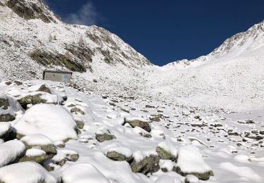
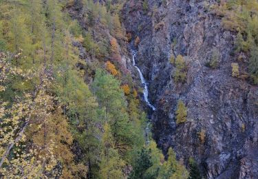
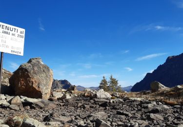
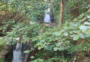
Trail Walking of 12.8 km to be discovered at Provence-Alpes-Côte d'Azur, Maritime Alps, Isola. This trail is proposed by Renefrt.
Description
les 3/4 sur piste
Positioning
Country:
France
Region :
Provence-Alpes-Côte d'Azur
Department/Province :
Maritime Alps
Municipality :
Isola
Location:
Unknown
Start:(Dec)
Start:(UTM)
344006 ; 4894407 (32T) N.
Comments
Trails nearby
Châtaigneraie ISOLA
Walking
Very easy
(1)
Isola,
Provence-Alpes-Côte d'Azur,
Maritime Alps,
France
2h 9min
Yes
Lacs du Lausfer / pas de Ste Anne
Walking
Easy
Isola,
Provence-Alpes-Côte d'Azur,
Maritime Alps,
France
9.7 km | 20 km-effort
3h 9min
Yes
Boucle de Louch
On foot
Easy
Isola,
Provence-Alpes-Côte d'Azur,
Maritime Alps,
France
4.6 km | 9.3 km-effort
2h 6min
Yes
Col de la Guercha
Walking
Very difficult
Isola,
Provence-Alpes-Côte d'Azur,
Maritime Alps,
France
11.3 km | 27 km-effort
5h 4min
Yes
Chapelle Ste Eurosie
Walking
Medium
Isola,
Provence-Alpes-Côte d'Azur,
Maritime Alps,
France
6.9 km | 17.6 km-effort
4h 44min
Yes
Pas de Ste Anne Hiver
Walking
Medium
Isola,
Provence-Alpes-Côte d'Azur,
Maritime Alps,
France
6.8 km | 15.1 km-effort
3h 7min
Yes
canyon du Bausset 20-08-2023
Walking
Difficult
Isola,
Provence-Alpes-Côte d'Azur,
Maritime Alps,
France
6.4 km | 12.6 km-effort
9h 20min
No
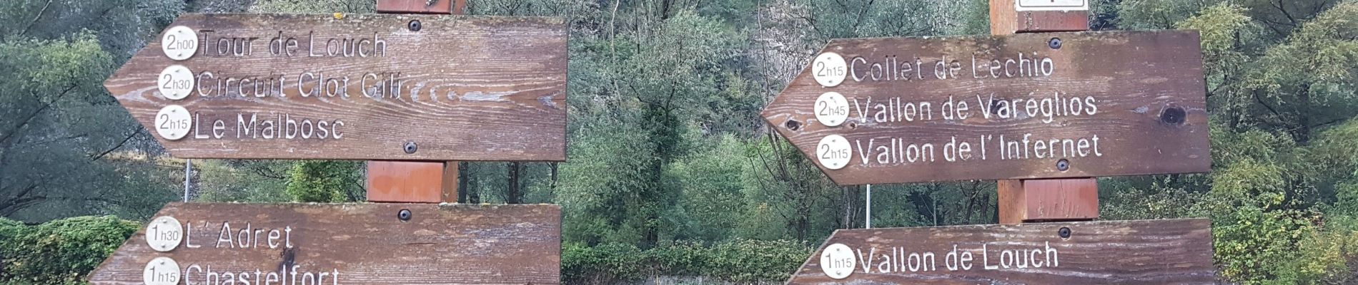
On peut commencer cette randonnée par la droite ou la gauche