Trail Touring skiing Aime-la-Plagne - le Crêt du Rey face Est - Photo
 nadd73
nadd73

User

© OpenStreetMap contributors
Length
Length
18.7 km
Max alt
Max alt
2598 m
Uphill gradient
Uphill gradient
1324 m
Km-Effort
Km-Effort  
36 km
Min alt
Min alt
1305 m
Downhill gradient
Downhill gradient
1335 m
Boucle
Boucle
Yes
Creation date :
2020-01-12 07:35:44.415
Updated on :
2020-01-12 17:16:48.017

(0 Reviews)

Touring skiing
Touring skiing
8h21
Difficulty : Difficult

Scan this QR Code to open this trail in the SityTrail application

FREE GPS app for hiking

Logo SityTrail SityTrail

IGN / Geographical institutes

Download SityTrail from the App Store Download SityTrail from Google Play

Logo SityTrail SityTrail World

The world is yours!

Download SityTrail from the App Store Download SityTrail from Google Play Download SityTrail on Huawei AppGallery

About

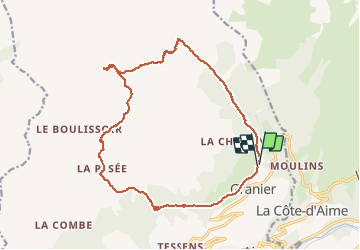
Trail Touring skiing of 18.7 km to be discovered at Auvergne-Rhône-Alpes, Savoy, Aime-la-Plagne. This trail is proposed by nadd73.

Description

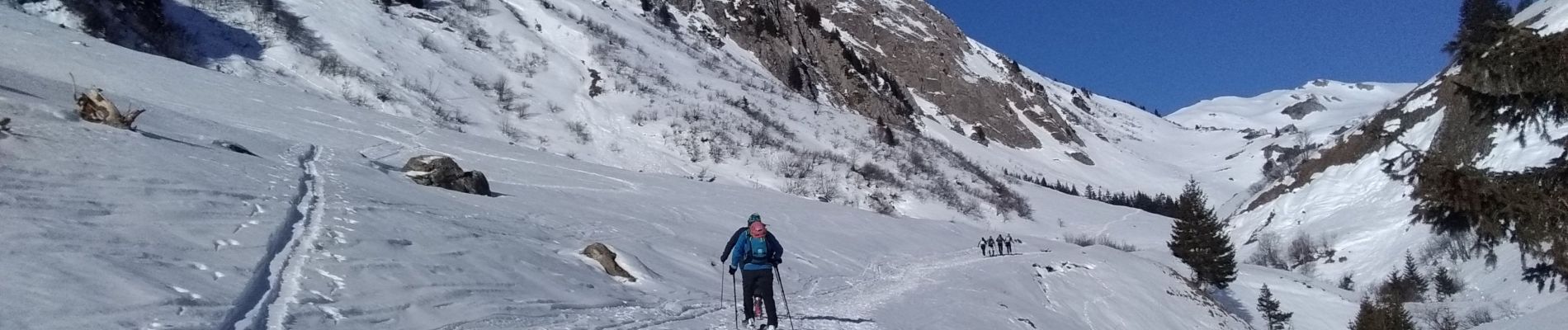
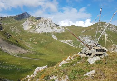
De Granier après le télésiège nous avons pris le GR du Beaufortain jusqu'à Laval et Pré jeune. ensuite suivre le ruisseau. la montée dans le couloir Est est exposé mieux prendre l'arête NE qui est souvent tracée. Crampons nécessaires suivant la neige.
Descente dans le couloir repeauter pour monter au col de corne noire.
Descente sur Fruit et la Pesée.
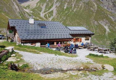
Au Chapieu  il est préférable de prendre le chemin qui mène au milieu du télésiège et il restera plus qu'à descendre à la voiture.

Elevation profile

Photos

Positioning

Country:
France
Region :
Auvergne-Rhône-Alpes
Department/Province :
Savoy
Municipality :
Aime-la-Plagne
Location:
Granier
Start:(UTM)
316828 ; 5049886 (32T) N.

Trails nearby

Trail Walking La Plagne-Tarentaise - Les Fours  - Photo
Walking
jpduc

Walking

Easy
(2)
La Plagne-Tarentaise, Auvergne-Rhône-Alpes, Savoy, France
8.4 km | 11.7 km-effort
2h 50min
Yes
Trail Walking La Plagne-Tarentaise - Tarentaise-Col du Mont Rosset-Refuge de la Balme-Col de la Charbonnière-Lac de la Portette  - Photo
Walking
Maryma

Walking

Very difficult
(1)
La Plagne-Tarentaise, Auvergne-Rhône-Alpes, Savoy, France
14.5 km | 31 km-effort
6h 56min
Yes
Trail Walking Aime-la-Plagne - Balcons de Granier - Photo
Walking
patrando49

Walking

Easy
(2)
Aime-la-Plagne, Auvergne-Rhône-Alpes, Savoy, France
7.3 km | 12.6 km-effort
2h 48min
Yes
Trail Snowshoes Aime-la-Plagne - combe benite - Photo
Snowshoes
whisper73

Snowshoes

Difficult
(1)
Aime-la-Plagne, Auvergne-Rhône-Alpes, Savoy, France
5.3 km | 16.4 km-effort
2h 56min
No
Trail Walking Aime-la-Plagne - Lac de Presset par la Piera Menta depuis le Cornet d'Arêches - Photo
Walking
tyax93

Walking

Medium
(1)
Aime-la-Plagne, Auvergne-Rhône-Alpes, Savoy, France
17 km | 32 km-effort
6h 49min
Yes
Trail Walking Aime-la-Plagne - Mont Coin  - Photo
Walking
flip38

Walking

Medium
Aime-la-Plagne, Auvergne-Rhône-Alpes, Savoy, France
17 km | 32 km-effort
6h 59min
Yes
Trail Walking Aime-la-Plagne - Beaufortain: Autour de La Pierra Menta: J6 - Ref. de La Coire - Pk Laval - Photo
Walking
patjobou

Walking

Medium
Aime-la-Plagne, Auvergne-Rhône-Alpes, Savoy, France
10.4 km | 17 km-effort
3h 21min
No
Trail Walking La Plagne-Tarentaise - Beaufortain: Autour de La Pierra Menta: J1  Chapelle St Guérin - Ref de La Balme - Photo
Walking
patjobou

Walking

Medium
La Plagne-Tarentaise, Auvergne-Rhône-Alpes, Savoy, France
7.1 km | 15.8 km-effort
2h 46min
No
Trail Walking Aime-la-Plagne - château de Menthon - Photo
Walking
François COLLIEUX

Walking

Medium
Aime-la-Plagne, Auvergne-Rhône-Alpes, Savoy, France
55 km | 143 km-effort
1h 26min
No


Close
My subscriptions