


Reallon-Serre du Mouton 7km

thonyc
User GUIDE
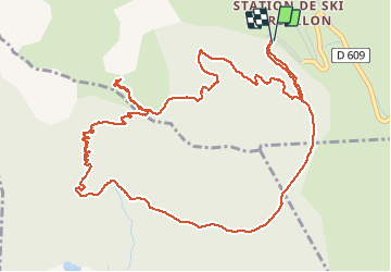

Length
7.3 km

Max alt
1963 m

Uphill gradient
429 m
Km-Effort
13 km

Min alt
1550 m

Downhill gradient
425 m
Boucle
Yes
Creation date :
2020-08-02 08:00:46.099
Updated on :
2020-08-04 08:55:36.152
2h53
Difficulty : Easy

FREE GPS app for hiking
 SityTrail
IGN / Geographical institutes
SityTrail Plus
The world is yours!
About
Trail Walking of 7.3 km to be discovered at Provence-Alpes-Côte d'Azur, Hautes-Alpes, Réallon. This trail is proposed by thonyc.
Description
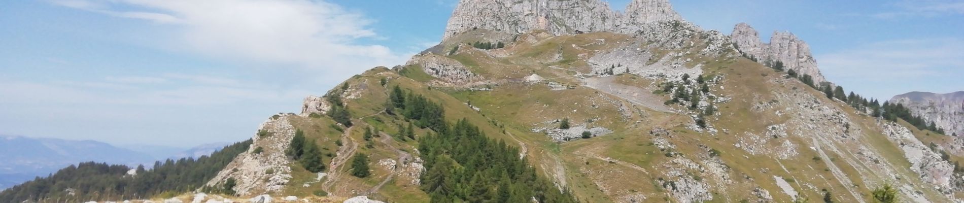
Très jolie randonnée sans difficulté particulière avec de très beaux panoramas.
Possibilité de prolonger l'aller-retour jusqu'au chalet au pied des aiguilles de Chabrières
Photos


Positioning
Country:
France
Region :
Provence-Alpes-Côte d'Azur
Department/Province :
Hautes-Alpes
Municipality :
Réallon
Location:
Unknown
Start:(Dec)
Start:(UTM)
290558 ; 4939202 (32T) N.
Comments