


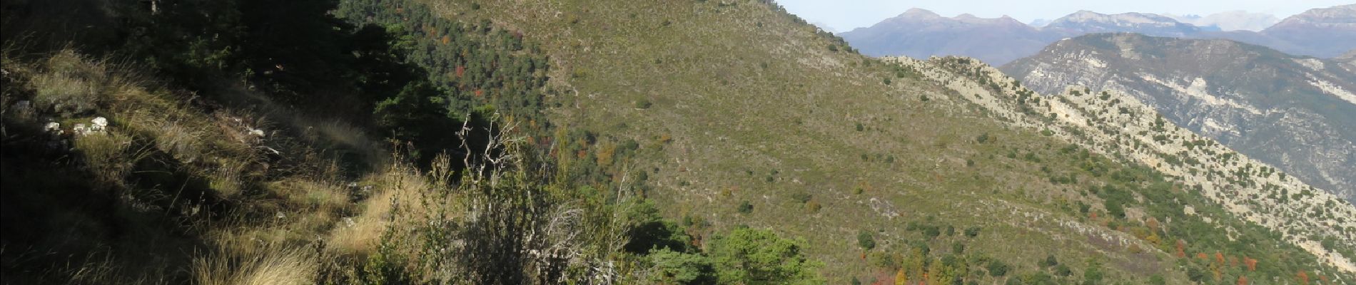
Mont Brune depuis Toudon

aris
User
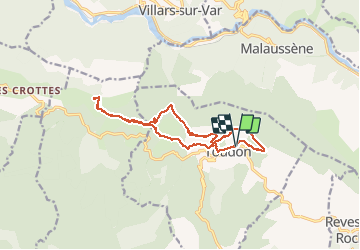

Length
14.7 km

Max alt
1501 m

Uphill gradient
972 m
Km-Effort
28 km

Min alt
984 m

Downhill gradient
968 m
Boucle
Yes
Creation date :
2020-10-25 07:22:30.684
Updated on :
2020-10-25 15:26:34.673
5h53
Difficulty : Medium

FREE GPS app for hiking
 SityTrail
IGN / Geographical institutes
SityTrail Plus
The world is yours!
About
Trail Walking of 14.7 km to be discovered at Provence-Alpes-Côte d'Azur, Maritime Alps, Toudon. This trail is proposed by aris.
Description
Randonnée facile qui offre de beaux panoramas sur la vallée du Var et le bord de Mer, l'Esteron et le Mercantour. En automne, les couleurs sont superbes.
Photos


Positioning
Country:
France
Region :
Provence-Alpes-Côte d'Azur
Department/Province :
Maritime Alps
Municipality :
Toudon
Location:
Unknown
Start:(Dec)
Start:(UTM)
348785 ; 4862808 (32T) N.
Comments