


Footing MORTREE 9

yannick-p
User

Length
6.2 km

Max alt
189 m

Uphill gradient
38 m
Km-Effort
6.8 km

Min alt
166 m

Downhill gradient
40 m
Boucle
Yes
Creation date :
2014-12-10 00:00:00.0
Updated on :
2014-12-10 00:00:00.0
35m
Difficulty : Unknown

FREE GPS app for hiking
 SityTrail
IGN / Geographical institutes
SityTrail Plus
The world is yours!
About
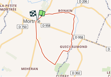
Trail Running of 6.2 km to be discovered at Normandy, Orne, Mortrée. This trail is proposed by yannick-p.
Positioning
Country:
France
Region :
Normandy
Department/Province :
Orne
Municipality :
Mortrée
Location:
Mortrée
Start:(Dec)
Start:(UTM)
284970 ; 5391516 (31U) N.
Comments