Trail Walking Llo - Llo, le Pla de la  Creu - Photo

Llo, le Pla de la Creu

© OpenStreetMap contributors
Length
Length
6.9 km
Max alt
Max alt
2047 m
Uphill gradient
Uphill gradient
681 m
Km-Effort
Km-Effort  
16 km
Min alt
Min alt
1369 m
Downhill gradient
Downhill gradient
682 m
Boucle
Boucle
Yes
Creation date :
2021-05-06 07:45:40.398
Updated on :
2021-05-06 07:53:05.358

(0 Reviews)

Walking
Walking
3h37
Difficulty : Difficult

Scan this QR Code to open this trail in the SityTrail application

FREE GPS app for hiking

Logo SityTrail SityTrail

IGN / Geographical institutes

Download SityTrail from the App Store Download SityTrail from Google Play

Logo SityTrail SityTrail World

The world is yours!

Download SityTrail from the App Store Download SityTrail from Google Play Download SityTrail on Huawei AppGallery

About

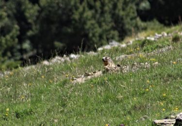
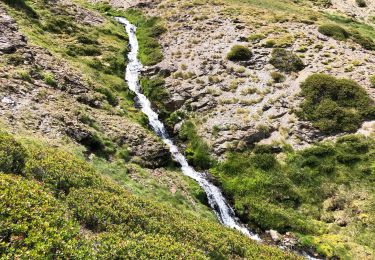
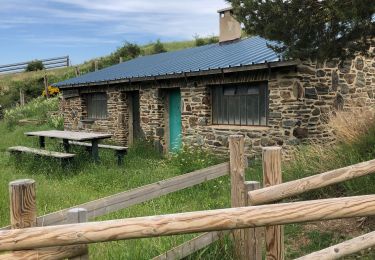
Trail Walking of 6.9 km to be discovered at Occitania, Pyrénées-Orientales, Llo. This trail is proposed by rene091957.

Description

Parking Bains de Llo, chemin de Védrignan, chemin de droite après le pont, le Devesa del Pastoret , sentier à droite vers le Pla de la Creu (2056 m). Descente vres Llo par la liaison de la sourcière, rejoint la boucle des Maquisards. Arrivée par le lavoir à Llo.

Elevation profile

Positioning

Country:
France
Region :
Occitania
Department/Province :
Pyrénées-Orientales
Municipality :
Llo
Location:
Unknown
Start:(UTM)
422660 ; 4700598 (31T) N.

Trails nearby

Trail Walking Eyne - Eyne,col de Nuria,pic d'Eyne,Torre d'Eyne,Eyne. - Photo
Walking
Machaon6

Walking

Very difficult
(1)
Eyne, Occitania, Pyrénées-Orientales, France
24 km | 43 km-effort
8h 44min
Yes
Trail Walking Eyne - Le Cambre d'Ase - Photo
Walking
tracegps

Walking

Difficult
(1)
Eyne, Occitania, Pyrénées-Orientales, France
8.9 km | 22 km-effort
4h 0min
Yes
Trail Walking Eyne - Vallée d'Eyne - Photo
Walking
GUIDE
nadinebondoux

Walking

Medium
Eyne, Occitania, Pyrénées-Orientales, France
10.7 km | 17.6 km-effort
4h 40min
Yes
Trail Walking Saint-Pierre-dels-Forcats - bains  de St Thomas  - Photo
Walking
Ptitjack30

Walking

Medium
(1)
Saint-Pierre-dels-Forcats, Occitania, Pyrénées-Orientales, France
8.6 km | 12.2 km-effort
2h 42min
No
Trail Walking Eyne - eyne - Photo
Walking
gardelg

Walking

Medium
(2)
Eyne, Occitania, Pyrénées-Orientales, France
6.2 km | 8.2 km-effort
2h 1min
Yes
Trail Walking Eyne - La vallée d'Eyne - Photo
Walking
suresnois

Walking

Difficult
Eyne, Occitania, Pyrénées-Orientales, France
11.2 km | 18 km-effort
7h 8min
Yes
Trail Walking Eyne - 20210722 vallée d’Eyne-Pic de Nuria et Finestrelle - Photo
Walking
ThonyM

Walking

Difficult
Eyne, Occitania, Pyrénées-Orientales, France
21 km | 37 km-effort
5h 56min
Yes
Trail Walking Saillagouse - 20210627 à partir de Saillagouse  - Photo
Walking
ThonyM

Walking

Medium
(1)
Saillagouse, Occitania, Pyrénées-Orientales, France
16.2 km | 26 km-effort
3h 47min
Yes
Trail Trail Font-Romeu-Odeillo-Via - Sortie trail - Photo
Trail
Cedric Pucheux

Trail

Difficult
(1)
Font-Romeu-Odeillo-Via, Occitania, Pyrénées-Orientales, France
11.8 km | 17.8 km-effort
1h 37min
Yes


Close
My subscriptions