


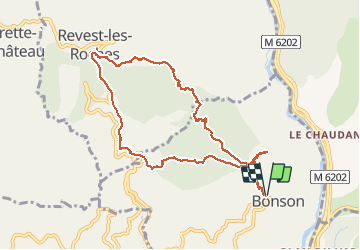
boucle de Revest à partir de Bonson

franquen
User

Length
10 km

Max alt
814 m

Uphill gradient
706 m
Km-Effort
19.4 km

Min alt
359 m

Downhill gradient
700 m
Boucle
Yes
Creation date :
2021-05-16 09:13:22.345
Updated on :
2021-05-16 15:26:13.0
5h49
Difficulty : Medium

FREE GPS app for hiking
 SityTrail
IGN / Geographical institutes
SityTrail Plus
The world is yours!
About
Trail Walking of 10 km to be discovered at Provence-Alpes-Côte d'Azur, Maritime Alps, Bonson. This trail is proposed by franquen.
Positioning
Country:
France
Region :
Provence-Alpes-Côte d'Azur
Department/Province :
Maritime Alps
Municipality :
Bonson
Location:
Unknown
Start:(Dec)
Start:(UTM)
354411 ; 4858289 (32T) N.
Comments