Trail Walking Beissat - Circuit des Roches de Murat - Photo

Circuit des Roches de Murat

© OpenStreetMap contributors
Length
Length
8.1 km
Max alt
Max alt
825 m
Uphill gradient
Uphill gradient
250 m
Km-Effort
Km-Effort  
11.4 km
Min alt
Min alt
707 m
Downhill gradient
Downhill gradient
248 m
Boucle
Boucle
Yes
Creation date :
2021-05-17 12:26:11.731
Updated on :
2021-05-17 14:48:14.343

(0 Reviews)

Walking
Walking
2h02
Difficulty : Medium

Scan this QR Code to open this trail in the SityTrail application

FREE GPS app for hiking

Logo SityTrail SityTrail

IGN / Geographical institutes

Download SityTrail from the App Store Download SityTrail from Google Play

Logo SityTrail SityTrail World

The world is yours!

Download SityTrail from the App Store Download SityTrail from Google Play Download SityTrail on Huawei AppGallery

About

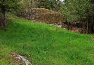
Trail Walking of 8.1 km to be discovered at New Aquitaine, Creuse, Beissat. This trail is proposed by Lecoester.

Description

Joli circuit pas très compliqué avec de beaux points de vues. comprend un aller retour de 1,5n km pour voir les roches.

Elevation profile

Photos

Positioning

Country:
France
Region :
New Aquitaine
Department/Province :
Creuse
Municipality :
Beissat
Location:
Unknown
Start:(UTM)
444133 ; 5068991 (31T) N.

Trails nearby

Trail Walking Malleret - Roc de Pierre Fade - Photo
Walking
Lecoester

Walking

Easy
Malleret, New Aquitaine, Creuse, France
5.1 km | 6.5 km-effort
1h 16min
Yes


Close
My subscriptions