![](/images/other/stat-length.png)
![Trail Walking Saint-Honoré - Le Grand Serre - Photo](https://media.geolcdn.com/t/1900/400/ext.pjpeg?maxdim=2&url=https%3A%2F%2Fmedia.geolcdn.com%2Ff%2Fea564edc-db3e-467a-9f34-8236705096bb.jpg)
Le Grand Serre
GuyVachet
User
![Length](/images/other/stat-length.png)
![Max alt](https://static1.geolcdn.com/siteimages/upload/files/1508320355ic_sort_altitude_max_24dp.png)
![Uphill gradient](https://static1.geolcdn.com/siteimages/upload/files/1508320355ic_sort_den_pos_24dp.png)
![Km-Effort](/images/other/stat-length.png)
![Min alt](https://static1.geolcdn.com/siteimages/upload/files/1508320355ic_sort_altitude_min_24dp.png)
![Downhill gradient](https://static1.geolcdn.com/siteimages/upload/files/1508320355ic_sort_den_neg_24dp.png)
![Boucle](https://static1.geolcdn.com/siteimages/upload/files/16400158638029165_repeat_loop_refresh_sync_direction_icon.png)
![Walking](https://static1.geolcdn.com/sitytour/trail-icons/101.png)
6h00
Difficulty : Difficult
![Scan this QR Code to open this trail in the SityTrail application](https://capi.geolives.com/qq0zvz2zws4bq2lad0pu/sitytour/trails/2813002/qr.png?size=200)
FREE GPS app for hiking
About
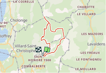
Trail Walking of 13.1 km to be discovered at Auvergne-Rhône-Alpes, Isère, Saint-Honoré. This trail is proposed by GuyVachet.
Description
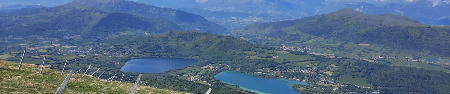
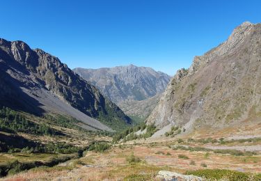
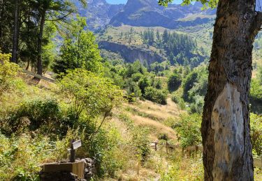
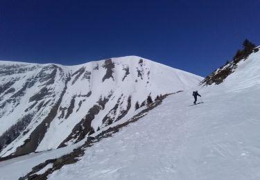
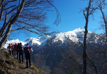
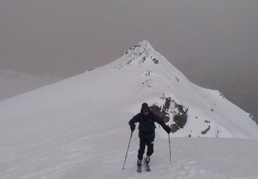
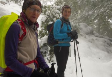
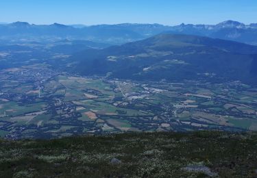
Boucle à partir de St-Honoré pour le Grand Serre. Le départ suit sur une grande piste, passage à la Croix du Gouret avec une belle vue sur le Vercors et le Dévoluy. Au niveau de la Cabane des Cloutons, montée directe sous le téléski pour arriver aux Cytrières dont l'altitude est quasiment celle du Grand Serre. Le sommet est alors à moins d'un kilomètre et offre un très beau point de vue à 360° du Taillefer à Grenoble, le Vercors et en contre-bas, les lacs de Laffrey. Redescente au Col du Parché et continuer la boucle au pied du Pérollier jusqu'au Col de l'Ollière. De là la descente finale jusqu'au point de départ en passant par le Lac de Charlet. Tout au long du parcours, le terrain est parsemé de fleurs.
Positioning
Comments
Trails nearby
![Trail Walking Lavaldens - Le Mollard - Lac Rif Bruyant 01/10/2023 - Photo](https://media.geolcdn.com/t/375/260/ext.jpg?maxdim=2&url=https%3A%2F%2Fmedia.geolcdn.com%2Ff%2F19c40cca-c1c5-4cd2-837c-cfeae0558b05.jpg)
![Walking Walking](https://static1.geolcdn.com/sitytour/trail-icons/101.png)
Walking
![](/images/other/stat-length.png)
![](https://static1.geolcdn.com/siteimages/upload/files/16400158638029165_repeat_loop_refresh_sync_direction_icon.png)
![Trail Walking Lavaldens - 2022-07-20_17h08m14_Rif Bruyant - Photo](https://media.geolcdn.com/t/375/260/ext.jpg?maxdim=2&url=https%3A%2F%2Fstatic1.geolcdn.com%2Fsiteimages%2Fupload%2Ffiles%2F1553511878bg_sport_marche.png)
![Walking Walking](https://static1.geolcdn.com/sitytour/trail-icons/101.png)
Walking
![](/images/other/stat-length.png)
![](https://static1.geolcdn.com/siteimages/upload/files/16400158638029165_repeat_loop_refresh_sync_direction_icon.png)
![Trail Mountain bike Pierre-Châtel - Tour des lacs Pierre-Chatel - Photo](https://media.geolcdn.com/t/375/260/ext.jpg?maxdim=2&url=https%3A%2F%2Fstatic1.geolcdn.com%2Fsiteimages%2Fupload%2Ffiles%2F1524743154velo.jpg)
![Mountain bike Mountain bike](https://static1.geolcdn.com/sitytour/trail-icons/202.png)
Mountain bike
![](/images/other/stat-length.png)
![](https://static1.geolcdn.com/siteimages/upload/files/16400158638029165_repeat_loop_refresh_sync_direction_icon.png)
![Trail Walking Lavaldens - Rif Bruyant - Photo](https://media.geolcdn.com/t/375/260/ext.jpg?maxdim=2&url=https%3A%2F%2Fmedia.geolcdn.com%2Ff%2F8dcecefd-d7fb-4568-9f12-c9e9cddea53d.jpg)
![Walking Walking](https://static1.geolcdn.com/sitytour/trail-icons/101.png)
Walking
![](/images/other/stat-length.png)
![](https://static1.geolcdn.com/siteimages/upload/files/16400158638029165_repeat_loop_refresh_sync_direction_icon.png)
![Trail Touring skiing Saint-Honoré - Le perollier, le Grand Serre - Photo](https://media.geolcdn.com/t/375/260/ext.jpg?maxdim=2&url=https%3A%2F%2Fmedia.geolcdn.com%2Ff%2F8f028379-4012-403e-a754-1ba5ea0046bf.jpg)
![Touring skiing Touring skiing](https://static1.geolcdn.com/sitytour/trail-icons/503.png)
Touring skiing
![](/images/other/stat-length.png)
![](https://static1.geolcdn.com/siteimages/upload/files/16400158638029165_repeat_loop_refresh_sync_direction_icon.png)
![Trail Walking La Valette - La cabane de Poyet en circuit - Photo](https://media.geolcdn.com/t/375/260/ext.jpg?maxdim=2&url=https%3A%2F%2Fmedia.geolcdn.com%2Ff%2F5619e671-6185-4bcc-8e40-810ed807016c.jpg)
![Walking Walking](https://static1.geolcdn.com/sitytour/trail-icons/101.png)
Walking
![](/images/other/stat-length.png)
![](https://static1.geolcdn.com/siteimages/upload/files/16400158638029165_repeat_loop_refresh_sync_direction_icon.png)
![Trail Touring skiing Saint-Honoré - Tabor de la Mûre - Photo](https://media.geolcdn.com/t/375/260/ext.jpg?maxdim=2&url=https%3A%2F%2Fmedia.geolcdn.com%2Ff%2F20d14802-7ff5-4d88-956a-7b9a995b765e.jpg)
![Touring skiing Touring skiing](https://static1.geolcdn.com/sitytour/trail-icons/503.png)
Touring skiing
![](/images/other/stat-length.png)
![](https://static1.geolcdn.com/siteimages/upload/files/16400158638029165_repeat_loop_refresh_sync_direction_icon.png)
![Trail Walking La Valette - Cabane ONF du Poyet, depuis la Valette - Photo](https://media.geolcdn.com/t/375/260/ext.jpg?maxdim=2&url=https%3A%2F%2Fmedia.geolcdn.com%2Ff%2F93222bd8-8947-41da-825b-3739799a19df.jpg)
![Walking Walking](https://static1.geolcdn.com/sitytour/trail-icons/101.png)
Walking
![](/images/other/stat-length.png)
![](https://static1.geolcdn.com/siteimages/upload/files/16400158638029165_repeat_loop_refresh_sync_direction_icon.png)
![Trail Walking Saint-Honoré - Tabor de Matheysine en circuit - Photo](https://media.geolcdn.com/t/375/260/ext.jpg?maxdim=2&url=https%3A%2F%2Fmedia.geolcdn.com%2Ff%2Feac49f4f-8e36-400c-8bb1-5aa35be03a49.jpg)
![Walking Walking](https://static1.geolcdn.com/sitytour/trail-icons/101.png)
Walking
![](/images/other/stat-length.png)
![](https://static1.geolcdn.com/siteimages/upload/files/16400158638029165_repeat_loop_refresh_sync_direction_icon.png)