


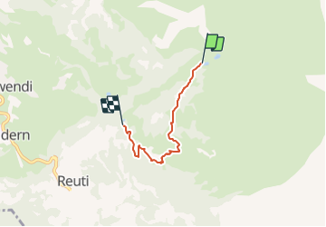

3.2 km | 4.5 km-effort

Tous les sentiers balisés d’Europe PRO


FREE GPS app for hiking
 SityTrail
IGN / Geographical institutes
SityTrail World
The world is yours!
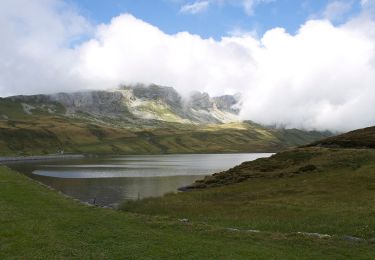
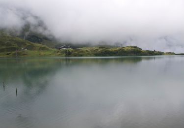
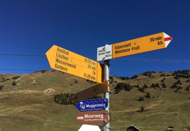
Trail On foot of 3.4 km to be discovered at Bern, Interlaken-Oberhasli administrative district, Hasliberg. This trail is proposed by SityTrail - itinéraires balisés pédestres.
Website: https://www.meiringen-hasliberg.ch/en/Summer/Muggestutz


On foot
On foot
On foot
On foot

Other activity

Walking
Other activity