![](/images/other/stat-length.png)
![Trail On foot Zaragoza - Estación Goya-La Junquera - Photo](https://media.geolcdn.com/t/1900/400/ext.pjpeg?maxdim=2&url=https%3A%2F%2Fmedia.geolcdn.com%2Ff%2F06c7be34-b44f-4670-b02e-9b4120c0ec3b.jpeg)
Estación Goya-La Junquera
SityTrail - itinéraires balisés pédestres
Tous les sentiers balisés d’Europe PRO
![Length](/images/other/stat-length.png)
Length
4.5 km
![Max alt](https://static1.geolcdn.com/siteimages/upload/files/1508320355ic_sort_altitude_max_24dp.png)
Max alt
249 m
![Uphill gradient](https://static1.geolcdn.com/siteimages/upload/files/1508320355ic_sort_den_pos_24dp.png)
Uphill gradient
60 m
![Km-Effort](/images/other/stat-length.png)
Km-Effort
5.3 km
![Min alt](https://static1.geolcdn.com/siteimages/upload/files/1508320355ic_sort_altitude_min_24dp.png)
Min alt
219 m
![Downhill gradient](https://static1.geolcdn.com/siteimages/upload/files/1508320355ic_sort_den_neg_24dp.png)
Downhill gradient
45 m
![Boucle](https://static1.geolcdn.com/siteimages/upload/files/16400158638029165_repeat_loop_refresh_sync_direction_icon.png)
Boucle
No
Signpost
Creation date :
2022-02-14 15:26:51.304
Updated on :
2022-02-14 15:26:51.304
![On foot](https://static1.geolcdn.com/sitytour/trail-icons/100.png)
1h12
Difficulty : Easy
![Scan this QR Code to open this trail in the SityTrail application](https://capi.geolives.com/qq0zvz2zws4bq2lad0pu/sitytour/trails/3110184/qr.png?size=200)
FREE GPS app for hiking
About
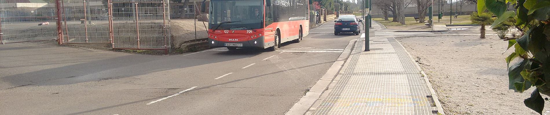
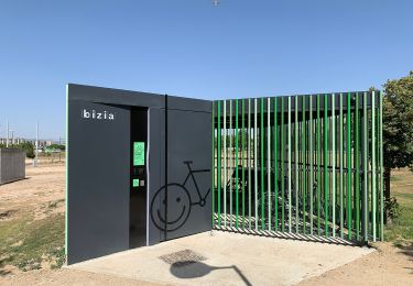
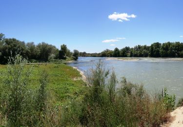
Trail On foot of 4.5 km to be discovered at Aragon, Zaragoza, Zaragoza. This trail is proposed by SityTrail - itinéraires balisés pédestres.
Description
Trail created by Zaragoza Deporte.
Website: https://zaragozanda.zaragozadeporte.com/Ruta7.asp
Positioning
Country:
Spain
Region :
Aragon
Department/Province :
Zaragoza
Municipality :
Zaragoza
Location:
Universidad
Start:(Dec)
Start:(UTM)
675587 ; 4612399 (30T) N.
Comments
Trails nearby
![Trail On foot Zaragoza - Ruta de los Parques - Photo](https://media.geolcdn.com/t/375/260/ext.jpg?maxdim=2&url=https%3A%2F%2Fmedia.geolcdn.com%2Ff%2F20c2e90a-8d27-4f43-b0ba-c8e3ce82099e.jpeg)
![On foot On foot](https://static1.geolcdn.com/sitytour/trail-icons/100.png)
![Trail On foot Zaragoza - Valdespartera-Plaza - Photo](https://media.geolcdn.com/t/375/260/ext.jpg?maxdim=2&url=https%3A%2F%2Fmedia.geolcdn.com%2Ff%2Fda5a88d4-7e53-40ac-bf12-348905ee1929.jpeg)
![On foot On foot](https://static1.geolcdn.com/sitytour/trail-icons/100.png)
Valdespartera-Plaza
On foot
Easy
Zaragoza,
Aragon,
Zaragoza,
Spain
![](/images/other/stat-length.png)
12.6 km | 13.8 km-effort
3h 8min
![](https://static1.geolcdn.com/siteimages/upload/files/16400158638029165_repeat_loop_refresh_sync_direction_icon.png)
No
![Trail On foot Zaragoza - Valdefierro-Plaza - Photo](https://media.geolcdn.com/t/375/260/ext.jpg?maxdim=2&url=https%3A%2F%2Fmedia.geolcdn.com%2Ff%2F9374466b-ac68-4991-b37d-cc4da7c2c961.jpeg)
![On foot On foot](https://static1.geolcdn.com/sitytour/trail-icons/100.png)
![Trail On foot Zaragoza - Ruta Alto Canal: Valdefierro-Torrero - Photo](https://media.geolcdn.com/t/375/260/ext.jpg?maxdim=2&url=https%3A%2F%2Fmedia.geolcdn.com%2Ff%2F757742e9-8375-4040-a123-38f838a3baf4.jpeg)
![On foot On foot](https://static1.geolcdn.com/sitytour/trail-icons/100.png)
Ruta Alto Canal: Valdefierro-Torrero
On foot
Easy
Zaragoza,
Aragon,
Zaragoza,
Spain
![](/images/other/stat-length.png)
6.7 km | 7.5 km-effort
1h 41min
![](https://static1.geolcdn.com/siteimages/upload/files/16400158638029165_repeat_loop_refresh_sync_direction_icon.png)
No
![Trail On foot Zaragoza - Desembocadura del Gállego - Photo](https://media.geolcdn.com/t/375/260/ext.jpg?maxdim=2&url=https%3A%2F%2Fmedia.geolcdn.com%2Ff%2Fc4e5fbee-ba95-4f95-a62d-76c502ba0314.jpeg)
![On foot On foot](https://static1.geolcdn.com/sitytour/trail-icons/100.png)
Desembocadura del Gállego
On foot
Easy
Zaragoza,
Aragon,
Zaragoza,
Spain
![](/images/other/stat-length.png)
5.4 km | 6 km-effort
1h 22min
![](https://static1.geolcdn.com/siteimages/upload/files/16400158638029165_repeat_loop_refresh_sync_direction_icon.png)
Yes
![Trail On foot Zaragoza - Paseando por los tres ríos - Photo](https://media.geolcdn.com/t/375/260/ext.jpg?maxdim=2&url=https%3A%2F%2Fmedia.geolcdn.com%2Ff%2Fbe816433-4bfc-43ba-98d2-a7158e283d93.jpeg)
![On foot On foot](https://static1.geolcdn.com/sitytour/trail-icons/100.png)
Paseando por los tres ríos
On foot
Easy
Zaragoza,
Aragon,
Zaragoza,
Spain
![](/images/other/stat-length.png)
5.2 km | 5.7 km-effort
1h 18min
![](https://static1.geolcdn.com/siteimages/upload/files/16400158638029165_repeat_loop_refresh_sync_direction_icon.png)
No
![Trail On foot Zaragoza - La margen izquierda, entre puentes - Photo](https://media.geolcdn.com/t/375/260/ext.jpg?maxdim=2&url=https%3A%2F%2Fmedia.geolcdn.com%2Ff%2F005040ae-58df-41b3-a633-d40a9669220b.jpeg)
![On foot On foot](https://static1.geolcdn.com/sitytour/trail-icons/100.png)
La margen izquierda, entre puentes
On foot
Easy
Zaragoza,
Aragon,
Zaragoza,
Spain
![](/images/other/stat-length.png)
5.5 km | 6.3 km-effort
1h 25min
![](https://static1.geolcdn.com/siteimages/upload/files/16400158638029165_repeat_loop_refresh_sync_direction_icon.png)
No
![Trail On foot Zaragoza - Camino Natural del Ebro de Zaragoza a La Cartuja - Photo](https://media.geolcdn.com/t/375/260/ext.jpg?maxdim=2&url=https%3A%2F%2Fmedia.geolcdn.com%2Ff%2F3f2c429e-c4f7-4370-8cd1-fcbe75bcd69e.jpeg)
![On foot On foot](https://static1.geolcdn.com/sitytour/trail-icons/100.png)
Camino Natural del Ebro de Zaragoza a La Cartuja
On foot
Easy
Zaragoza,
Aragon,
Zaragoza,
Spain
![](/images/other/stat-length.png)
8.8 km | 9.6 km-effort
2h 11min
![](https://static1.geolcdn.com/siteimages/upload/files/16400158638029165_repeat_loop_refresh_sync_direction_icon.png)
No
![Trail On foot Zaragoza - Ruta circular por el Canal y los pinares de Venecia - Photo](https://media.geolcdn.com/t/375/260/ext.jpg?maxdim=2&url=https%3A%2F%2Fmedia.geolcdn.com%2Ff%2F09b2353d-bca5-480a-bf9e-6901522de82c.jpeg)
![On foot On foot](https://static1.geolcdn.com/sitytour/trail-icons/100.png)
Ruta circular por el Canal y los pinares de Venecia
On foot
Easy
Zaragoza,
Aragon,
Zaragoza,
Spain
![](/images/other/stat-length.png)
8.2 km | 9.5 km-effort
2h 9min
![](https://static1.geolcdn.com/siteimages/upload/files/16400158638029165_repeat_loop_refresh_sync_direction_icon.png)
Yes