Trail Walking Lecques - lecques-viclefesc-ND-Fontaned - Photo

lecques-viclefesc-ND-Fontaned

 v.rabot
v.rabot

User

© OpenStreetMap contributors
Length
Length
18.3 km
Max alt
Max alt
156 m
Uphill gradient
Uphill gradient
270 m
Km-Effort
Km-Effort  
22 km
Min alt
Min alt
33 m
Downhill gradient
Downhill gradient
270 m
Boucle
Boucle
Yes
Creation date :
2022-04-05 07:09:41.893
Updated on :
2022-04-05 14:46:28.203

(0 Reviews)

Walking
Walking
5h00
Difficulty : Medium

Scan this QR Code to open this trail in the SityTrail application

FREE GPS app for hiking

Logo SityTrail SityTrail

IGN / Geographical institutes

Download SityTrail from the App Store Download SityTrail from Google Play

Logo SityTrail SityTrail World

The world is yours!

Download SityTrail from the App Store Download SityTrail from Google Play Download SityTrail on Huawei AppGallery

About

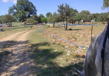
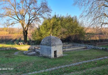
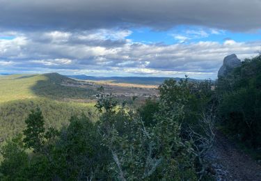
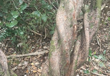
Trail Walking of 18.3 km to be discovered at Occitania, Gard, Lecques. This trail is proposed by v.rabot.

Description

Partant du parking près du Vidourle à Lecques (payant en saison estivale et inondable en période d'épisodes cévenoles), on longe le Vidourle jusqu'à Viq le Fesc ou l'on pourra admirer les anciens puits, l'église, l'ancien hôtel des postes et de nombreuses maisons bien rénovées, on grimpe en direction de la Croix, on passe par une capitelle, puis la Vierge et on arrive à Notre Dame de Prime Combe qui comporte de très nombreux symboles religieux, on redescend vers Fontanès en passant près de la Bergerie de Glaizes, qui n'a plus de toiture, de fontanés jusqu'à Lecques, on traverse de nombreuses vignes  dont une à une taille particulière A ne pas faire à la saison chaude, n'oubliez pas de vous assurer qu'il n'y aura pas de battue de sanglier là avant de faire cette randonnée

Elevation profile

Photos

35 photos in total. Please click on a photo to see them all in the gallery.

Positioning

Country:
France
Region :
Occitania
Department/Province :
Gard
Municipality :
Lecques
Location:
Unknown
Start:(UTM)
585699 ; 4854091 (31T) N.

Trails nearby

Trail Walking Fontanès - FONTANÉS 30 - SALINELLES - PONDRES - ballade autour du Vidourle  - Photo
Walking
jeff66

Walking

Medium
(2)
Fontanès, Occitania, Gard, France
10.7 km | 12.7 km-effort
1h 59min
Yes
Trail Horseback riding Orthoux-Sérignac-Quilhan - mas bas - corconnes en boucle - Photo
Horseback riding
GUIDE
David25400

Horseback riding

Medium
Orthoux-Sérignac-Quilhan, Occitania, Gard, France
22 km | 26 km-effort
4h 51min
Yes
Trail Walking Saint-Clément - Le bois de Paris - Grotte, Table d'orientation, Oppidum - Photo
Walking
f4tnk

Walking

Medium
(1)
Saint-Clément, Occitania, Gard, France
8.2 km | 10.9 km-effort
2h 29min
Yes
Trail Walking Salinelles - salinelles-pondres-souvignargues-fontanes - Photo
Walking
v.rabot

Walking

Medium
Salinelles, Occitania, Gard, France
14.7 km | 17.2 km-effort
4h 14min
Yes
Trail Walking Combas - Combats Montpezat - Photo
Walking
v.rabot

Walking

Difficult
Combas, Occitania, Gard, France
14.2 km | 17.4 km-effort
3h 57min
Yes
Trail Walking Aspères - Aspères - Photo
Walking
GUIDE
Roger Philippe Wallez

Walking

Difficult
Aspères, Occitania, Gard, France
12.6 km | 16.4 km-effort
4h 26min
Yes
Trail Walking Combas - Combas - Photo
Walking
guyzinz

Walking

Very difficult
Combas, Occitania, Gard, France
16.6 km | 22 km-effort
6h 8min
Yes
Trail Walking Aspères - Asperes-stClement-gailhan-lecques - Photo
Walking
v.rabot

Walking

Medium
Aspères, Occitania, Gard, France
16.3 km | 19.5 km-effort
4h 44min
Yes
Trail Walking Garrigues - Le bois de Paris - Photo
Walking
daniel34

Walking

Medium
Garrigues, Occitania, Hérault, France
14 km | 18 km-effort
4h 0min
No


Close
My subscriptions