Trail Road bike Cognin-les-Gorges - Alpes 2022 / Cognin-les-Gorges / Pas du Mortier (tunnel) + Col du Mont Noir  - Photo

Alpes 2022 / Cognin-les-Gorges / Pas du Mortier (tunnel) + Col du Mont Noir

 bosses21
bosses21

User

© OpenStreetMap contributors
Length
Length
94 km
Max alt
Max alt
1540 m
Uphill gradient
Uphill gradient
2796 m
Km-Effort
Km-Effort  
131 km
Min alt
Min alt
178 m
Downhill gradient
Downhill gradient
2793 m
Boucle
Boucle
Yes
Creation date :
2022-05-26 09:36:32.325
Updated on :
2022-06-14 10:04:06.635

(0 Reviews)

Road bike
Road bike
7h57
Difficulty : Very difficult

Scan this QR Code to open this trail in the SityTrail application

FREE GPS app for hiking

Logo SityTrail SityTrail

IGN / Geographical institutes

Download SityTrail from the App Store Download SityTrail from Google Play

Logo SityTrail SityTrail World

The world is yours!

Download SityTrail from the App Store Download SityTrail from Google Play Download SityTrail on Huawei AppGallery

About

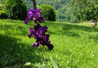
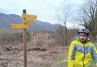
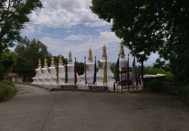
Trail Road bike of 94 km to be discovered at Auvergne-Rhône-Alpes, Isère, Cognin-les-Gorges. This trail is proposed by bosses21.

Description

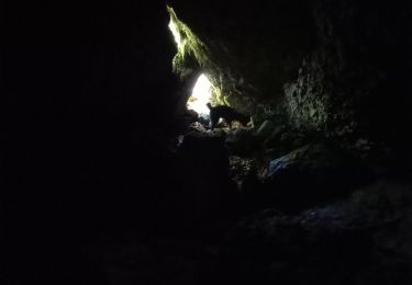
Col de Montaud - Pas du Mortier (tunnel) - Col de Romeyère - Col du Mont Noir - Pas du Pré Coquet

Elevation profile

Points of interest

Point of interest La Rivière - Col de Montaud - Photo
bosses21
LA RIVIÈRE 
Point of interest Autrans-Méaudre en Vercors - Pas du Mortier (tunnel) - Photo
bosses21
AUTRANS-MÉAUDRE EN VERCORS 
Point of interest Rencurel - Col de Romeyère - Photo
bosses21
Point of interest Rencurel - Col du Mont Noir - Photo
bosses21
Point of interest Malleval-en-Vercors - Pas du Pré Coquet - Photo
bosses21
MALLEVAL-EN-VERCORS 

Positioning

Country:
France
Region :
Auvergne-Rhône-Alpes
Department/Province :
Isère
Municipality :
Cognin-les-Gorges
Location:
Unknown
Start:(UTM)
689826 ; 5004858 (31T) N.

Trails nearby

Trail Walking Cognin-les-Gorges - gerlette abs - Photo
Walking
dorane

Walking

Very easy
(1)
Cognin-les-Gorges, Auvergne-Rhône-Alpes, Isère, France
15.8 km | 31 km-effort
7h 12min
Yes
Trail Walking Malleval-en-Vercors - pas du Follet en boucle - Photo
Walking
cmarit

Walking

Medium
(1)
Malleval-en-Vercors, Auvergne-Rhône-Alpes, Isère, France
16.7 km | 26 km-effort
6h 59min
Yes
Trail Mountain bike Vinay - Vinay-Plaine-Pont de Treillins - Photo
Mountain bike
crocau

Mountain bike

Very easy
Vinay, Auvergne-Rhône-Alpes, Isère, France
10 km | 11.7 km-effort
1h 11min
Yes
Trail Walking Malleval-en-Vercors - Patente - Photo
Walking
crocau

Walking

Difficult
Malleval-en-Vercors, Auvergne-Rhône-Alpes, Isère, France
9.9 km | 13.4 km-effort
3h 7min
Yes
Trail Walking Cognin-les-Gorges - Cognin-les-Gorges - Gorges du Nan - Malleval-en-Vercors - Photo
Walking
Philindy26

Walking

Difficult
Cognin-les-Gorges, Auvergne-Rhône-Alpes, Isère, France
15.6 km | 30 km-effort
5h 30min
Yes
Trail Walking Izeron - La lunette- fontaine et grotte de Byry - Photo
Walking
crocau

Walking

Medium
Izeron, Auvergne-Rhône-Alpes, Isère, France
4.8 km | 7.4 km-effort
3h 0min
Yes
Trail Walking Izeron - 38 izeron - Photo
Walking
GUIDE
randodyssée

Walking

Medium
Izeron, Auvergne-Rhône-Alpes, Isère, France
15.8 km | 30 km-effort
6h 39min
Yes
Trail Walking Cognin-les-Gorges - Cognin les gorges  - Photo
Walking
Sylvie.P

Walking

Medium
Cognin-les-Gorges, Auvergne-Rhône-Alpes, Isère, France
15.5 km | 30 km-effort
4h 28min
No
Trail Walking Cognin-les-Gorges - Les gorges du Nan - Photo
Walking
crocau

Walking

Medium
Cognin-les-Gorges, Auvergne-Rhône-Alpes, Isère, France
4.8 km | 11.4 km-effort
2h 13min
Yes


Close
My subscriptions