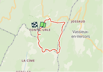
![](/images/other/stat-length.png)
![Trail Walking Bouvante - Fond d'Urle Chaud Clapier - Photo](https://media.geolcdn.com/t/1900/400/ext.pjpeg?maxdim=2&url=https%3A%2F%2Fmedia.geolcdn.com%2Ff%2F4a8e0c5c-95fa-438b-87df-304eace0b559.jpg)
Fond d'Urle Chaud Clapier
TOULAUDIN
User
![Length](/images/other/stat-length.png)
![Max alt](https://static1.geolcdn.com/siteimages/upload/files/1508320355ic_sort_altitude_max_24dp.png)
![Uphill gradient](https://static1.geolcdn.com/siteimages/upload/files/1508320355ic_sort_den_pos_24dp.png)
![Km-Effort](/images/other/stat-length.png)
![Min alt](https://static1.geolcdn.com/siteimages/upload/files/1508320355ic_sort_altitude_min_24dp.png)
![Downhill gradient](https://static1.geolcdn.com/siteimages/upload/files/1508320355ic_sort_den_neg_24dp.png)
![Boucle](https://static1.geolcdn.com/siteimages/upload/files/16400158638029165_repeat_loop_refresh_sync_direction_icon.png)
![Walking](https://static1.geolcdn.com/sitytour/trail-icons/101.png)
4h10
Difficulty : Medium
![Scan this QR Code to open this trail in the SityTrail application](https://capi.geolives.com/qq0zvz2zws4bq2lad0pu/sitytour/trails/3259243/qr.png?size=200)
FREE GPS app for hiking
About
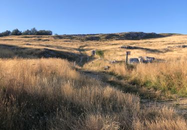
Trail Walking of 12.7 km to be discovered at Auvergne-Rhône-Alpes, Drôme, Bouvante. This trail is proposed by TOULAUDIN.
Description
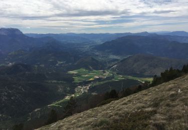
très beau parcours réalisé le 27/5/22 par fort Mistral 45km/H supportable
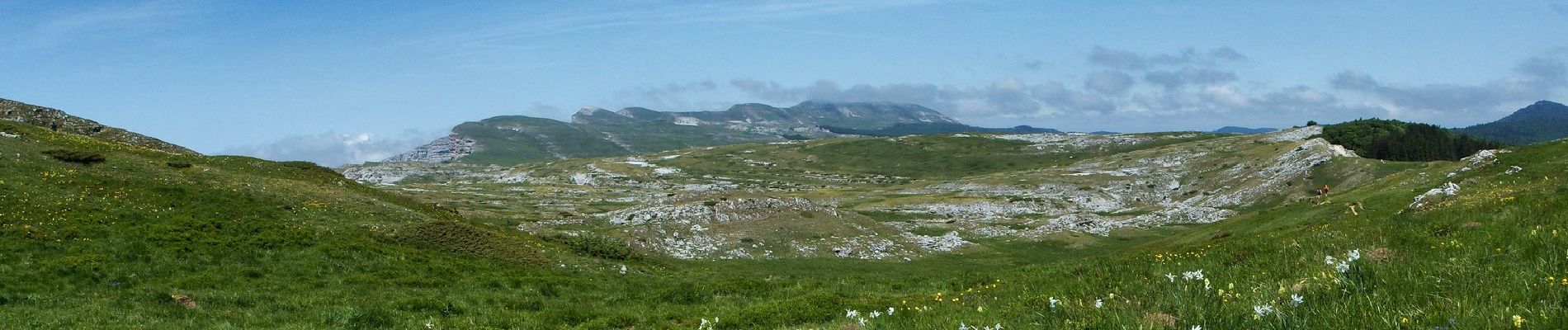
mais pas confortable.à noter toutefois une fois passé le puy de la Gagère sur le sentier du bas ( coin abrité pour le pique nique au pot de la croix),on est un peu abrité et le passage en forêt encore mieux.il y a à faire aussi le sentier du karst voir le parcours dans vercors rando
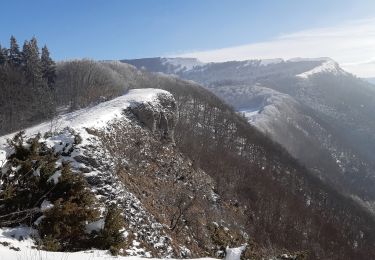
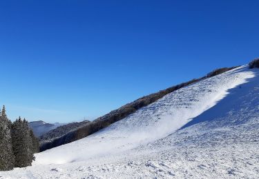
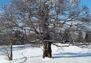
conseil : rando à faire par temps calme et ensoleillé suivant la saison flore différente ( crocus début du printemps) très beau parcours raquettes ATTENTION AU BROUILLARD bref soyez vigilants
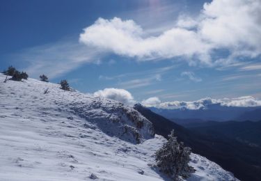
Positioning
Comments
Trails nearby
![Trail Snowshoes Bouvante - Les gagères en raquettes - Photo](https://media.geolcdn.com/t/375/260/ext.jpg?maxdim=2&url=https%3A%2F%2Fmedia.geolcdn.com%2Ff%2F2981cf80-2281-48d0-9011-dd17ca071224.jpg)
![Snowshoes Snowshoes](https://static1.geolcdn.com/sitytour/trail-icons/504.png)
Snowshoes
![](/images/other/stat-length.png)
![](https://static1.geolcdn.com/siteimages/upload/files/16400158638029165_repeat_loop_refresh_sync_direction_icon.png)
![Trail Walking Bouvante - 01 - Photo](https://media.geolcdn.com/t/375/260/ext.jpg?maxdim=2&url=https%3A%2F%2Fservices.sitytrail.com%2FGeolivesWS%2FDownloadMedia.ashx%3FTrailID%3D835352%26Media%3Dfix__20170924162337.jpg)
![Walking Walking](https://static1.geolcdn.com/sitytour/trail-icons/101.png)
Walking
![](/images/other/stat-length.png)
![](https://static1.geolcdn.com/siteimages/upload/files/16400158638029165_repeat_loop_refresh_sync_direction_icon.png)
![Trail Walking Vassieux-en-Vercors - Vassieux-en-Vercors - Le Puy de la Gagère - Photo](https://media.geolcdn.com/t/375/260/ext.jpg?maxdim=2&url=https%3A%2F%2Fmedia.geolcdn.com%2Ff%2F1aad13f5-10ee-4304-b0fb-5635099ff701.jpg)
![Walking Walking](https://static1.geolcdn.com/sitytour/trail-icons/101.png)
Walking
![](/images/other/stat-length.png)
![](https://static1.geolcdn.com/siteimages/upload/files/16400158638029165_repeat_loop_refresh_sync_direction_icon.png)
![Trail Walking Bouvante - Font d’Urle les Trois cloches Glacières les Gagères - Photo](https://media.geolcdn.com/t/375/260/ext.jpg?maxdim=2&url=https%3A%2F%2Fmedia.geolcdn.com%2Ff%2Fd811593c-e678-4b00-a285-b7dce29eecce.jpg)
![Walking Walking](https://static1.geolcdn.com/sitytour/trail-icons/101.png)
Walking
![](/images/other/stat-length.png)
![](https://static1.geolcdn.com/siteimages/upload/files/16400158638029165_repeat_loop_refresh_sync_direction_icon.png)
![Trail Walking Vassieux-en-Vercors - But St Genis - Photo](https://media.geolcdn.com/t/375/260/ext.jpg?maxdim=2&url=https%3A%2F%2Fmedia.geolcdn.com%2Ff%2F7dc5994c-58ff-4977-a518-836cfc09796c.jpg)
![Walking Walking](https://static1.geolcdn.com/sitytour/trail-icons/101.png)
Walking
![](/images/other/stat-length.png)
![](https://static1.geolcdn.com/siteimages/upload/files/16400158638029165_repeat_loop_refresh_sync_direction_icon.png)
![Trail Walking Vassieux-en-Vercors - Forêt communale de Dié - Photo](https://media.geolcdn.com/t/375/260/ext.jpg?maxdim=2&url=https%3A%2F%2Fmedia.geolcdn.com%2Ff%2F81a065f0-a659-4198-8cfc-a4d3daa2067f.jpg)
![Walking Walking](https://static1.geolcdn.com/sitytour/trail-icons/101.png)
Walking
![](/images/other/stat-length.png)
![](https://static1.geolcdn.com/siteimages/upload/files/16400158638029165_repeat_loop_refresh_sync_direction_icon.png)
![Trail Walking Bouvante - Crête des Gagères - Photo](https://media.geolcdn.com/t/375/260/ext.jpg?maxdim=2&url=https%3A%2F%2Fmedia.geolcdn.com%2Ff%2F238839e4-2c7b-463c-a8a4-13f730b00e0a.jpg)
![Walking Walking](https://static1.geolcdn.com/sitytour/trail-icons/101.png)
Walking
![](/images/other/stat-length.png)
![](https://static1.geolcdn.com/siteimages/upload/files/16400158638029165_repeat_loop_refresh_sync_direction_icon.png)
![Trail Nordic walking Bouvante - 202201fontdurle2 - Photo](https://media.geolcdn.com/t/375/260/ext.jpg?maxdim=2&url=https%3A%2F%2Fmedia.geolcdn.com%2Ff%2F148c551f-c1f7-4a77-89d2-b6cfec149cab.jpg)
![Nordic walking Nordic walking](https://static1.geolcdn.com/sitytour/trail-icons/102.png)
Nordic walking
![](/images/other/stat-length.png)
![](https://static1.geolcdn.com/siteimages/upload/files/16400158638029165_repeat_loop_refresh_sync_direction_icon.png)
![Trail Walking Saint-Julien-en-Quint - Puy de la Gagere, Porte d’Urle - Photo](https://media.geolcdn.com/t/375/260/ext.jpg?maxdim=2&url=https%3A%2F%2Fmedia.geolcdn.com%2Ff%2Fe2307571-55f1-4e4e-ad84-7190356d726e.jpg)
![Walking Walking](https://static1.geolcdn.com/sitytour/trail-icons/101.png)
Walking
![](/images/other/stat-length.png)
![](https://static1.geolcdn.com/siteimages/upload/files/16400158638029165_repeat_loop_refresh_sync_direction_icon.png)