


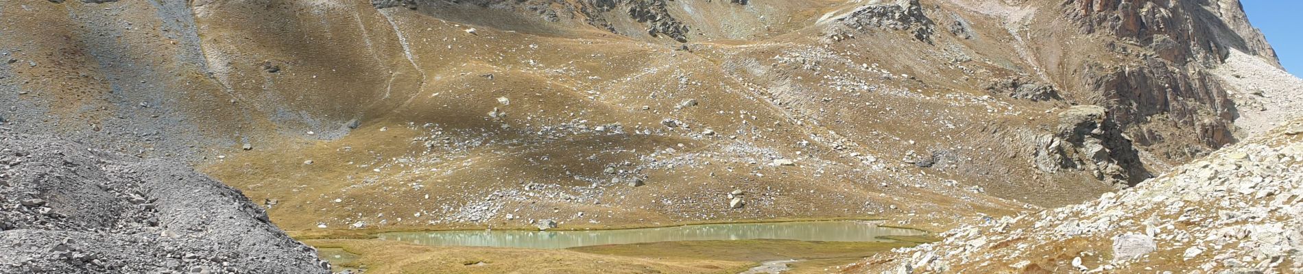
Col Mary et col marie Marinet

janussity
User
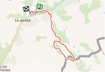

Length
18.3 km

Max alt
2787 m

Uphill gradient
921 m
Km-Effort
31 km

Min alt
1886 m

Downhill gradient
941 m
Boucle
No
Creation date :
2022-08-23 06:54:08.11
Updated on :
2022-08-23 15:31:04.025
5h37
Difficulty : Very difficult

FREE GPS app for hiking
 SityTrail
IGN / Geographical institutes
SityTrail Plus
The world is yours!
About
Trail Walking of 18.3 km to be discovered at Provence-Alpes-Côte d'Azur, Alpes-de-Haute-Provence, Saint-Paul-sur-Ubaye. This trail is proposed by janussity.
Description
OK plus mde glacier Marinet
Photos


Positioning
Country:
France
Region :
Provence-Alpes-Côte d'Azur
Department/Province :
Alpes-de-Haute-Provence
Municipality :
Saint-Paul-sur-Ubaye
Location:
Unknown
Start:(Dec)
Start:(UTM)
328615 ; 4939914 (32T) N.
Comments