Trail Road bike Vouthon-Haut - une virée autour de chez nous  - Photo

une virée autour de chez nous

  CDSM 55
CDSM 55

User

© OpenStreetMap contributors
Length
Length
61 km
Max alt
Max alt
428 m
Uphill gradient
Uphill gradient
678 m
Km-Effort
Km-Effort  
70 km
Min alt
Min alt
249 m
Downhill gradient
Downhill gradient
682 m
Boucle
Boucle
Yes
Creation date :
2022-08-30 12:56:20.016
Updated on :
2022-08-30 17:07:52.894

(1 Reviews)

Road bike
Road bike
3h28
Difficulty : Difficult

Scan this QR Code to open this trail in the SityTrail application

FREE GPS app for hiking

Logo SityTrail SityTrail

IGN / Geographical institutes

Download SityTrail from the App Store Download SityTrail from Google Play

Logo SityTrail SityTrail World

The world is yours!

Download SityTrail from the App Store Download SityTrail from Google Play Download SityTrail on Huawei AppGallery

About

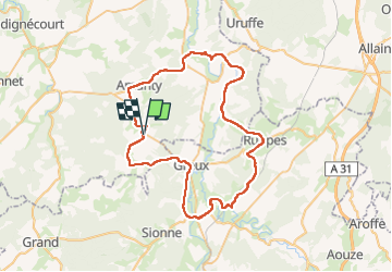
Trail Road bike of 61 km to be discovered at Grand Est, Meuse, Vouthon-Haut. This trail is proposed by CDSM 55.

Description

Un tour dans 3 départements !

Elevation profile

Positioning

Country:
France
Region :
Grand Est
Department/Province :
Meuse
Municipality :
Vouthon-Haut
Location:
Unknown
Start:(UTM)
693506 ; 5372561 (31U) N.

Comments

Please log in to post a review or rate the element


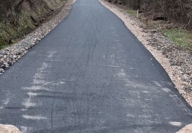
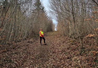
Belle boucle, mais temps lourd et vent du nord un peu costaud.Etat de la route correcte


Trails nearby

Trail Walking Vouthon-Haut - En mémoire de Sidonie - Photo
Walking
CDSM 55

Walking

Medium
(1)
Vouthon-Haut, Grand Est, Meuse, France
7.7 km | 9.3 km-effort
1h 46min
No
Trail Walking Vouthon-Haut - sur les chemins d'Isabelle partiel les Roises  - Photo
Walking
CDSM 55

Walking

Medium
(1)
Vouthon-Haut, Grand Est, Meuse, France
8.4 km | 11 km-effort
1h 8min
Yes
Trail Walking Vouthon-Haut - reco site VTT - Photo
Walking
CDSM 55

Walking

Easy
(1)
Vouthon-Haut, Grand Est, Meuse, France
4 km | 5.4 km-effort
1h 20min
Yes
Trail Walking Vouthon-Haut - Vouthon-Haut  - Photo
Walking
CDSM 55

Walking

Very difficult
(1)
Vouthon-Haut, Grand Est, Meuse, France
16.7 km | 19.5 km-effort
2h 41min
No
Trail Mountain bike Vouthon-Haut - Chemin d'Isabelle  partiel  - Photo
Mountain bike
CDSM 55

Mountain bike

Easy
(1)
Vouthon-Haut, Grand Est, Meuse, France
14.6 km | 17.4 km-effort
1h 8min
Yes
Trail Mountain bike Vouthon-Haut - Les Chemins d'Isabelle P2 - Photo
Mountain bike
CDSM 55

Mountain bike

Very difficult
(1)
Vouthon-Haut, Grand Est, Meuse, France
34 km | 42 km-effort
2h 54min
Yes
Trail Walking Vouthon-Haut - reco VTT Chemins d'Isabelle  - Photo
Walking
CDSM 55

Walking

Medium
(1)
Vouthon-Haut, Grand Est, Meuse, France
7.9 km | 10.9 km-effort
1h 17min
Yes
Trail On foot Domrémy-la-Pucelle - Sentier de Jeanne - Photo
On foot
PRO

On foot

Easy
Domrémy-la-Pucelle, Grand Est, Vosges, France
13.3 km | 16.4 km-effort
3h 43min
Yes
Trail On foot Domrémy-la-Pucelle - DOMRÉMY LA PUCELLE - Photo
On foot
jeannine grandjean

On foot

Easy
(1)
Domrémy-la-Pucelle, Grand Est, Vosges, France
10.9 km | 13.7 km-effort
3h 6min
Yes


Close
My subscriptions