Trail Mountain bike Orcet - vtt depart Orcet - Photo
© OpenStreetMap contributors
Length
Length
45 km
Max alt
Max alt
689 m
Uphill gradient
Uphill gradient
857 m
Km-Effort
Km-Effort  
57 km
Min alt
Min alt
321 m
Downhill gradient
Downhill gradient
857 m
Boucle
Boucle
Yes
Creation date :
2014-12-10 00:00:00.0
Updated on :
2014-12-10 00:00:00.0

(1 Reviews)

Mountain bike
Mountain bike
3h40
Difficulty : Medium

Scan this QR Code to open this trail in the SityTrail application

FREE GPS app for hiking

Logo SityTrail SityTrail

IGN / Geographical institutes

Download SityTrail from the App Store Download SityTrail from Google Play

Logo SityTrail SityTrail World

The world is yours!

Download SityTrail from the App Store Download SityTrail from Google Play Download SityTrail on Huawei AppGallery

About

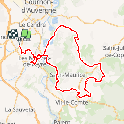
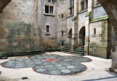
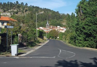
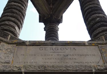
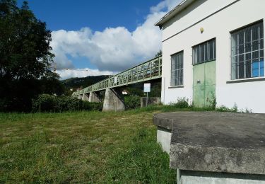
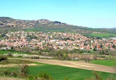
Trail Mountain bike of 45 km to be discovered at Auvergne-Rhône-Alpes, Puy-de-Dôme, Orcet. This trail is proposed by corzevasion.

Description

belle rando plus facile

Elevation profile

Positioning

Country:
France
Region :
Auvergne-Rhône-Alpes
Department/Province :
Puy-de-Dôme
Municipality :
Orcet
Location:
Unknown
Start:(Dec)
Start:(UTM)
513196 ; 5060753 (31T) N.

Comments

Please log in to post a review or rate the element


Belle rando, attention la partie autour du puy de serpanoux est impraticable , les chemins n'existent plus. Possibilité de contourner le puy de l'autre côté par les minassoles


Trails nearby

Trail Walking Le Cendre - Le_Cendre_Tour_1 - Photo
Walking
GUIDE
jagarnier

Walking

Easy
(1)
Le Cendre, Auvergne-Rhône-Alpes, Puy-de-Dôme, France
8.2 km | 10.1 km-effort
2h 30min
Yes
Trail On foot Le Cendre - De l'Auzon a Gondole - Photo
On foot
PRO

On foot

Easy
Le Cendre, Auvergne-Rhône-Alpes, Puy-de-Dôme, France
6.8 km | 7.7 km-effort
1h 44min
Yes
Trail On foot Veyre-Monton - Le Puy de Corent - Photo
On foot
PRO

On foot

Easy
Veyre-Monton, Auvergne-Rhône-Alpes, Puy-de-Dôme, France
5.8 km | 8.3 km-effort
1h 52min
Yes
Trail On foot Saint-Amant-Tallende - Le Puy de Peyronere - Photo
On foot
PRO

On foot

Easy
Saint-Amant-Tallende, Auvergne-Rhône-Alpes, Puy-de-Dôme, France
9.5 km | 13 km-effort
2h 57min
Yes
Trail On foot Chanonat - Le Puy de Jussat - Photo
On foot
PRO

On foot

Easy
Chanonat, Auvergne-Rhône-Alpes, Puy-de-Dôme, France
4.7 km | 6.8 km-effort
1h 32min
Yes
Trail On foot La Roche-Blanche - Le Plateau de Gergovie - Photo
On foot
PRO

On foot

Easy
La Roche-Blanche, Auvergne-Rhône-Alpes, Puy-de-Dôme, France
3.5 km | 4.4 km-effort
59min
Yes
Trail On foot Cournon-d'Auvergne - Bords d'Allier - Photo
On foot
PRO

On foot

Easy
Cournon-d'Auvergne, Auvergne-Rhône-Alpes, Puy-de-Dôme, France
6.6 km | 7.2 km-effort
1h 37min
Yes
Trail Walking La Roche-Blanche - Gergovie - Photo
Walking
scheat

Walking

Easy
(1)
La Roche-Blanche, Auvergne-Rhône-Alpes, Puy-de-Dôme, France
3.5 km | 4.3 km-effort
56min
Yes
Trail Walking Tallende - Tallende_Vergers - Photo
Walking
GUIDE
jagarnier

Walking

Easy
Tallende, Auvergne-Rhône-Alpes, Puy-de-Dôme, France
8.3 km | 10.5 km-effort
2h 30min
Yes


Close
My subscriptions