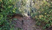
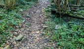
Trail Walking Ballancourt-sur-Essonne - Forêt Hospitalière de la Coudraye Ballancourt-sur-Essonne  - Photo

Forêt Hospitalière de la Coudraye Ballancourt-sur-Essonne

 guydu41
guydu41

User

© OpenStreetMap contributors
Length
Length
6.2 km
Max alt
Max alt
146 m
Uphill gradient
Uphill gradient
139 m
Km-Effort
Km-Effort  
8 km
Min alt
Min alt
73 m
Downhill gradient
Downhill gradient
139 m
Boucle
Boucle
Yes
Creation date :
2022-10-20 11:42:30.546
Updated on :
2022-10-21 14:50:20.527

(0 Reviews)

Walking
Walking
2h11
Difficulty : Difficult

Scan this QR Code to open this trail in the SityTrail application

FREE GPS app for hiking

Logo SityTrail SityTrail
IGN / Geographical institutes

Download SityTrail from the App Store Download SityTrail from Google Play

Logo SityTrail SityTrail World
The world is yours!

Download SityTrail from the App Store Download SityTrail from Google Play Download SityTrail on Huawei AppGallery

About

Trail Walking of 6.2 km to be discovered at Ile-de-France, Essonne, Ballancourt-sur-Essonne. This trail is proposed by guydu41.

Description

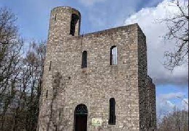
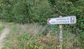
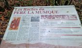
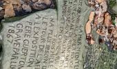
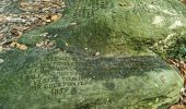
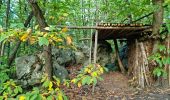
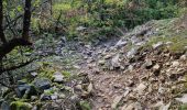
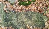
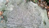
Ce circuit vous fera passer au milieu de plusieurs chaos rocheux, de voir un totem sculpté par un passionné, de longer la base de plusieurs escarpements rocheux avec de nombreuses cavités dont certaines sont explorables, de marcher sur des crêtes rocheuses avec des points de vue impressionnants, d'emprunter de nombreux sentiers étroits et tortueux, de découvrir les roches gravées du Père la Musique, etc.
Parcours exceptionnel.
Mise en garde : Le franchissement de deux crêtes se fait par des passages montants extrêmement pentus dont un très long

Elevation profile

Photos

69 photos in total. Please click on a photo to see them all in the gallery.

Positioning

Country:
France
Region :
Ile-de-France
Department/Province :
Essonne
Municipality :
Ballancourt-sur-Essonne
Location:
Unknown
Start:(UTM)
455182 ; 5374409 (31U) N.

Trails nearby

Trail Walking Champcueil - JC 51 - 18,4 km - 320m - Champcueil, Les Grands Avaux - 23 km Effort - Photo
Walking

Walking

Difficult
(1)
Champcueil, Ile-de-France, Essonne, France
17.7 km | 22 km-effort
4h 58min
Yes
Trail Walking Itteville - Les vieilles ailes - Photo
Walking
c.chehere

Walking

Easy
(1)
Itteville, Ile-de-France, Essonne, France
16.8 km | 19.2 km-effort
3h 37min
Yes
Trail On foot Itteville - Chemin des Marais - Photo
On foot
PRO

On foot

Easy
Itteville, Ile-de-France, Essonne, France
14.3 km | 16 km-effort
3h 38min
No
Trail On foot Champcueil - Balade entre Brie de Gâtinais - Photo
On foot
PRO

On foot

Easy
Champcueil, Ile-de-France, Essonne, France
13.1 km | 15.7 km-effort
3h 33min
No
Trail On foot Mennecy - Les Etangs de Mennecy - Photo
On foot

On foot

Difficult
(1)
Mennecy, Ile-de-France, Essonne, France
18.5 km | 21 km-effort
4h 3min
Yes
Trail Nordic walking Vert-le-Petit - vert le petit - Photo
Nordic walking
gwenleterrible

Nordic walking

Very easy
(1)
Vert-le-Petit, Ile-de-France, Essonne, France
7.9 km | 8.6 km-effort
2h 0min
Yes
Trail Nordic walking Mennecy - mennecy  vs mennecy - Photo
Nordic walking
gwenleterrible

Nordic walking

Very easy
(1)
Mennecy, Ile-de-France, Essonne, France
6.8 km | 7.6 km-effort
1h 40min
Yes
Trail Other activity Mennecy - mennecy grand tour marais - Photo
Other activity
Chantalhenryon

Other activity

Very easy
(1)
Mennecy, Ile-de-France, Essonne, France
19.1 km | 21 km-effort
6h 44min
Yes
Trail Walking Mennecy - Mennecy - Photo
Walking
IreneProvost

Walking

Easy
(1)
Mennecy, Ile-de-France, Essonne, France
14.1 km | 16 km-effort
3h 30min
Yes


Close
My subscriptions