


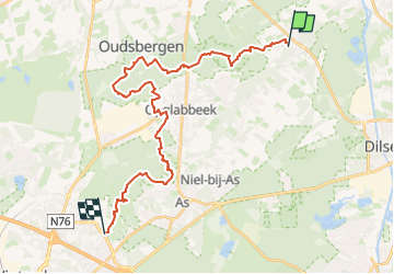

17.8 km | 20 km-effort

The Hoge Kempen National Park


FREE GPS app for hiking
 SityTrail
IGN / Geographical institutes
SityTrail World
The world is yours!
Trail On foot of 27 km to be discovered at Flanders, Limburg, Maaseik. This trail is proposed by National Park Trail.
A stage with two faces: the first part runs from east to west over an elongated series of land dunes, with the Oudsberg as the highest dune of the Kempen.
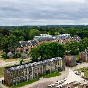
The second part leads you to the site of the former Waterschei coal mine (Thorpark).
From the top of the slagheap you have an almost complete view of the National Park. For those who want to, this "Gateway to the National Park" is a worthy end of the trail. There's a regular bus service from here to the train station of Genk.

Walking
On foot
On foot
On foot
On foot
On foot
On foot
On foot
On foot