


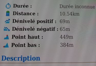
11 km | 12.7 km-effort

Si l'aventure est dangereuse, essayes la routine : elle est mortelle !


FREE GPS app for hiking
 SityTrail
IGN / Geographical institutes
SityTrail World
The world is yours!
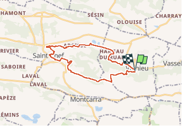
Trail Walking of 15.6 km to be discovered at Auvergne-Rhône-Alpes, Isère, Vignieu. This trail is proposed by Ballades lyonnaises.
Abbatiale St Chef - Fresques Chapelle Haute -Jardin médiéval
Nx Cimetiere (Frederic Dard) Canal des moines
Walking
Other activity
Walking

Walking
Walking

Cycle
Walking
Walking


sport