Trail Walking Bellefosse - Col de la Charbonnière - château de la Roche - Bellefosse - Belmont - Photo

Col de la Charbonnière - château de la Roche - Bellefosse - Belmont

 Bart2015
Bart2015

User

© OpenStreetMap contributors
Length
Length
15.7 km
Max alt
Max alt
966 m
Uphill gradient
Uphill gradient
624 m
Km-Effort
Km-Effort  
24 km
Min alt
Min alt
636 m
Downhill gradient
Downhill gradient
624 m
Boucle
Boucle
Yes
Creation date :
2023-07-09 08:04:10.747
Updated on :
2023-07-12 10:55:24.175

(0 Reviews)

Walking
Walking
5h27
Difficulty : Very difficult

Scan this QR Code to open this trail in the SityTrail application

FREE GPS app for hiking

Logo SityTrail SityTrail

IGN / Geographical institutes

Download SityTrail from the App Store Download SityTrail from Google Play

Logo SityTrail SityTrail World

The world is yours!

Download SityTrail from the App Store Download SityTrail from Google Play Download SityTrail on Huawei AppGallery

About

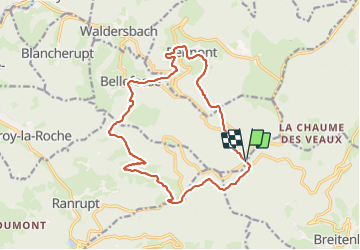
Trail Walking of 15.7 km to be discovered at Grand Est, Bas-Rhin, Bellefosse. This trail is proposed by Bart2015.

Description

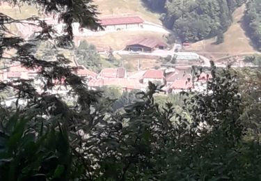
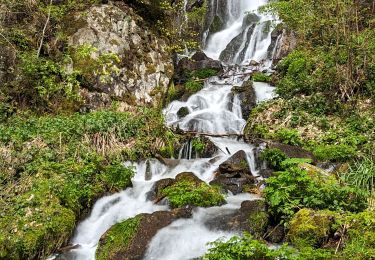
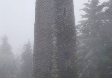
Randonnée que nous avons faite en période de canicule, idéale car bien boisée et en altitude. La tour du château est impressionnante sur son rocher, belle vue aux alentours. Nombreuses fontaines à Bellefosse, important par ces grosses chaleurs ...
Bonne rando ...

Elevation profile

Photos

Positioning

Country:
France
Region :
Grand Est
Department/Province :
Bas-Rhin
Municipality :
Bellefosse
Location:
Unknown
Start:(UTM)
370984 ; 5360414 (32U) N.

Trails nearby

Trail Walking Steige - Steige  blanc  - Photo
Walking
jean charles daniel.

Walking

Medium
(1)
Steige, Grand Est, Bas-Rhin, France
7.8 km | 12.6 km-effort
2h 7min
Yes
Trail Walking Villé - 67 VILLÉ  CLIMONT VILLÉ  - Photo
Walking
LUTZMarc

Walking

Medium
(1)
Villé, Grand Est, Bas-Rhin, France
22 km | 33 km-effort
5h 5min
Yes
Trail Walking Le Hohwald - suuntoapp-Hiking-2024-04-27T09-12-29Z - Photo
Walking
GUIDE
holtzv

Walking

Medium
Le Hohwald, Grand Est, Bas-Rhin, France
20 km | 31 km-effort
6h 58min
Yes
Trail Walking Solbach - Rando Solbach  - Photo
Walking
enciloti

Walking

Medium
(1)
Solbach, Grand Est, Bas-Rhin, France
4.6 km | 6.6 km-effort
1h 29min
Yes
Trail Walking Saint-Martin - 17.05.2020 - Saint Martin  - Photo
Walking
delm

Walking

Easy
(1)
Saint-Martin, Grand Est, Bas-Rhin, France
12.2 km | 17.7 km-effort
3h 56min
Yes
Trail Walking Ranrupt - 2018-12-30 Marche Climont Voyemont - Photo
Walking
GUIDE
holtzv

Walking

Very easy
Ranrupt, Grand Est, Bas-Rhin, France
22 km | 33 km-effort
7h 21min
Yes
Trail Walking Le Hohwald - Tour du Hohwald - Photo
Walking
zazie

Walking

Medium
(1)
Le Hohwald, Grand Est, Bas-Rhin, France
8 km | 11.3 km-effort
2h 26min
Yes
Trail Mountain bike Maisonsgoutte - Honel - Photo
Mountain bike
sanseya

Mountain bike

Medium
(1)
Maisonsgoutte, Grand Est, Bas-Rhin, France
15 km | 22 km-effort
1h 26min
Yes
Trail Horseback riding Belmont - Circuit VC Serva - Le Climont - Photo
Horseback riding
GUIDE+

Horseback riding

Medium
Belmont, Grand Est, Bas-Rhin, France
23 km | 33 km-effort
4h 20min
No


Close
My subscriptions