Trail Walking Chemilli - [Itinéraire] Les fours à chanvre - Photo

[Itinéraire] Les fours à chanvre

 ODDAD78
ODDAD78

User

© OpenStreetMap contributors
Length
Length
6 km
Max alt
Max alt
140 m
Uphill gradient
Uphill gradient
71 m
Km-Effort
Km-Effort  
6.9 km
Min alt
Min alt
104 m
Downhill gradient
Downhill gradient
73 m
Boucle
Boucle
Yes
Creation date :
2023-08-12 18:31:04.331
Updated on :
2023-08-12 18:54:52.523

(0 Reviews)

Walking
Walking
1h34
Difficulty : Medium
Mountain bike
Mountain bike
28m
Difficulty : Easy
Hybrid bike
Hybrid bike
--
Difficulty : Easy

Scan this QR Code to open this trail in the SityTrail application

FREE GPS app for hiking

Logo SityTrail SityTrail

IGN / Geographical institutes

Download SityTrail from the App Store Download SityTrail from Google Play

Logo SityTrail SityTrail World

The world is yours!

Download SityTrail from the App Store Download SityTrail from Google Play Download SityTrail on Huawei AppGallery

About

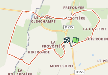
Trail Walking of 6 km to be discovered at Normandy, Orne, Chemilli. This trail is proposed by ODDAD78.

Description

Suivre la rue du Nord jusqu'au lieu-dit Le carrefour.
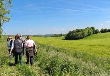
1. Prendre à gauche un chemin rural goudronné qui, par les Maisons Brûlées et Bois Robin, conduit à la Gaslerie (ancienne ferme). Traverser la cour et poursuivre par un chemin en herbe qui, bientôt, vire à gauche (point de vue sur la forêt domaniale de Bellême) et débouche sur la voie communale (VC3).
2. Tourner à gauche. La Petite Lasserie. La Petite Massotière. Au lieu-dit "le Vivier", prendre à gauche la D 275 sur une centaine de mètres.
3. A hauteur du délaissé de route, emprunter à droite un chemin herbeux en pente douce débouchant sur un chemin empierré. Tourner à gauche pour gagner le hameau du Grand Clinchamps. Descendre à droite la D 644. Franchir le ruisseau de Clinchamps. Ferme des Brianderies. Poursuivre tout droit.
4. A l'orée de la forêt de Clinchamps, prendre à gauche un chemin empierré. Passer devant la Roiserie. Toujours en lisière de forêt, continuer par un chemin en herbe. A l'entrée du sous-bois, quitter ce chemin pour virer à gauche en descendant. Jolie vue, à droite, sur l'ancien manoir de la Pillardière (aujourd'hui ce site accueille le jardin remarquable "Le jardin de Montperthuis"). Traverser à nouveau le ruisseau de Clinchamps sur une passerelle et remonter pour rejoindre la VC2.
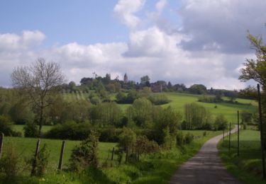
5. Tourner à gauche. Hirebonde. La Provostière (four à chanvre bien conservé).
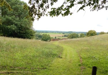
6. Prendre à droite un chemin en herbe qui contourne une parcelle et revient sur la VC2. A droite.
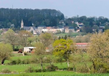
Arrivé dans le bourg de Chemilli, face à l'église, tourner à droite.
(Pas à pas : Rando-Perche)

Elevation profile

Points of interest

Positioning

Country:
France
Region :
Normandy
Department/Province :
Orne
Municipality :
Chemilli
Location:
Unknown
Start:(UTM)
310762 ; 5359637 (31U) N.

Trails nearby

Trail Walking Belforêt-en-Perche - La Perrière, forêt et village - Photo
Walking
jeannine grandjean

Walking

Difficult
Belforêt-en-Perche, Normandy, Orne, France
11.1 km | 13.8 km-effort
3h 8min
Yes
Trail Walking Belforêt-en-Perche - le chêne de l'école - Photo
Walking
fournieralain

Walking

Very easy
Belforêt-en-Perche, Normandy, Orne, France
15.7 km | 19.7 km-effort
6h 47min
Yes
Trail Walking Belforêt-en-Perche -  La Perrière - Saint-Germain-de-la-Coudre via Bellême (TCP) 28 km - Photo
Walking

Walking

Medium
Belforêt-en-Perche, Normandy, Orne, France
28 km | 35 km-effort
7h 16min
No
Trail Walking Belforêt-en-Perche - La Perrière - Saint-Germain-de-la-Coudre via Igé (TCP) 27 km - Photo
Walking

Walking

Easy
Belforêt-en-Perche, Normandy, Orne, France
27 km | 33 km-effort
7h 2min
No
Trail Walking Belforêt-en-Perche - La Perrière - Mortagne-au-Perche (TCP) 29 km - Photo
Walking

Walking

Difficult
Belforêt-en-Perche, Normandy, Orne, France
29 km | 34 km-effort
7h 18min
No
Trail Walking Belforêt-en-Perche - La Perrière : village millénaire - Photo
Walking
tracegps

Walking

Medium
Belforêt-en-Perche, Normandy, Orne, France
11.1 km | 14 km-effort
3h 0min
Yes
Trail Walking Belforêt-en-Perche - la perrière par la forêt  - Photo
Walking
Krissray

Walking

Medium
Belforêt-en-Perche, Normandy, Orne, France
5.6 km | 7.6 km-effort
1h 45min
Yes
Trail Walking Belforêt-en-Perche - fourneaux gr jusqu'au ruisseau - Photo
Walking
Krissray

Walking

Medium
Belforêt-en-Perche, Normandy, Orne, France
5 km | 6.7 km-effort
1h 15min
Yes
Trail Car Belforêt-en-Perche - 2023-12-6 Bellême VduP - Photo
Car
patrick2m

Car

Belforêt-en-Perche, Normandy, Orne, France
47 km | 56 km-effort
2h 48min
No


Close
My subscriptions