


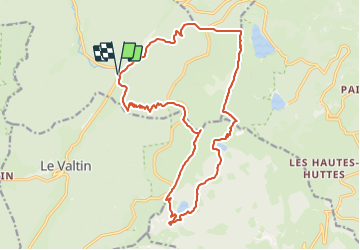

15.6 km | 26 km-effort


User


FREE GPS app for hiking
 SityTrail
IGN / Geographical institutes
SityTrail World
The world is yours!
Trail Walking of 19.3 km to be discovered at Grand Est, Vosges, Plainfaing. This trail is proposed by DanielROLLET.
2023 10 10 - Avec Marie - 10h05 à 17h45
Départ/retour parking Etang des Dames
Beau temps
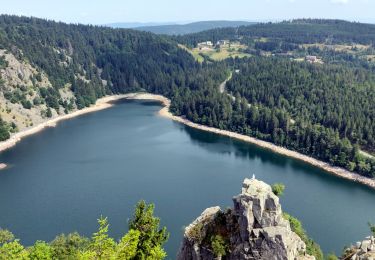
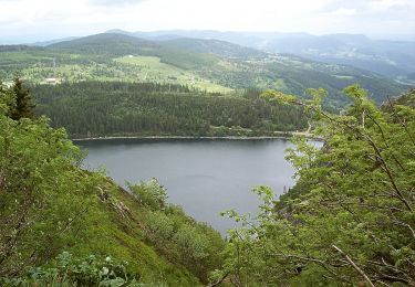
En arrivant au Lac Vert, nous avons préféré descendre sur la route
Pause 13h30 à 14h00 au Lac de Forlet (avec un vent trés froid!)
Belle balade
Partis un peu tard de Nancy...

Other activity

Walking

Walking

Walking

Mountain bike
Walking
On foot

Walking
Walking