


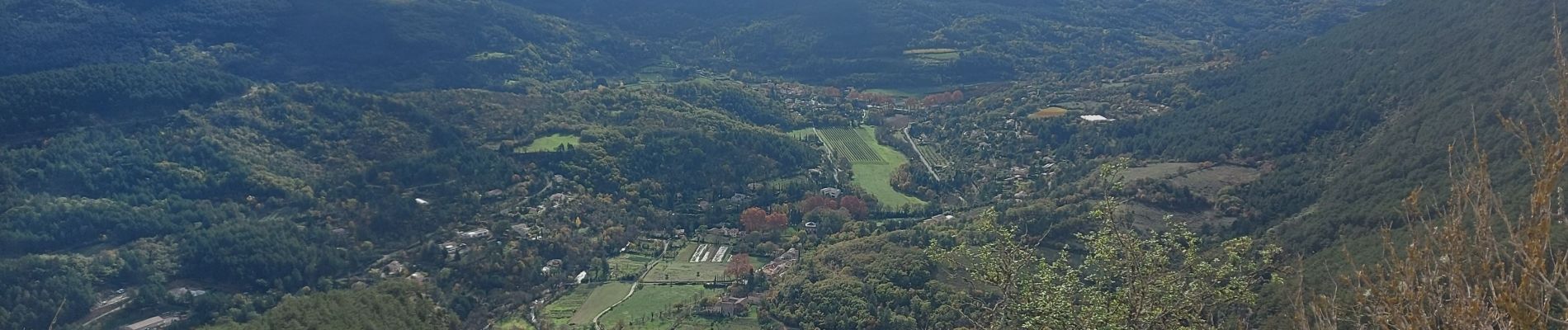
arsel soubes

labarone
User
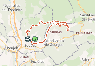

Length
17.8 km

Max alt
708 m

Uphill gradient
649 m
Km-Effort
26 km

Min alt
241 m

Downhill gradient
651 m
Boucle
Yes
Creation date :
2023-11-21 07:34:20.913
Updated on :
2023-11-21 14:03:02.073
6h27
Difficulty : Medium

FREE GPS app for hiking
 SityTrail
IGN / Geographical institutes
SityTrail Plus
The world is yours!
About
Trail Walking of 17.8 km to be discovered at Occitania, Hérault, Soubès. This trail is proposed by labarone.
Description
cool
Photos


Positioning
Country:
France
Region :
Occitania
Department/Province :
Hérault
Municipality :
Soubès
Location:
Unknown
Start:(Dec)
Start:(UTM)
528057 ; 4846077 (31T) N.
Comments