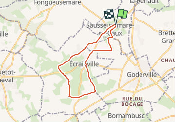
11.4 km | 13.1 km-effort
saussemarre
RoMo
User
Length
11.9 km
Max alt
137 m
Uphill gradient
132 m
Km-Effort
13.7 km
Min alt
88 m
Downhill gradient
131 m
Boucle
Yes
Creation date :
2024-01-14 07:57:25.451
Updated on :
2024-01-14 11:24:18.466
2h35
Difficulty : Medium
FREE GPS app for hiking
About
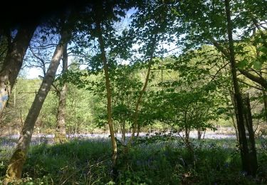
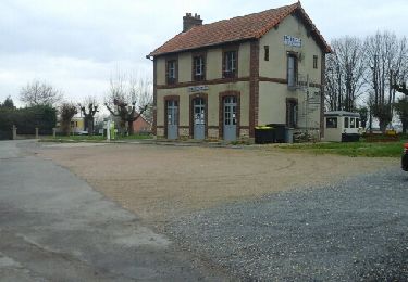
Trail Walking of 11.9 km to be discovered at Normandy, Seine-Maritime, Sausseuzemare-en-Caux. This trail is proposed by RoMo.
Description
boucle
Positioning
Country:
France
Region :
Normandy
Department/Province :
Seine-Maritime
Municipality :
Sausseuzemare-en-Caux
Location:
Unknown
Start:(Dec)
Start:(UTM)
308640 ; 5505123 (31U) N.
Comments
Trails nearby
les loges le mont roty
Walking
Very easy
Les Loges,
Normandy,
Seine-Maritime,
France
10.1 km | 11.6 km-effort
2h 28min
Yes
Les Loges: Le Mont Roty / Les Loges
Walking
Easy
Les Loges,
Normandy,
Seine-Maritime,
France
10 km | 11.5 km-effort
2h 32min
Yes
maniquerville
Walking
Medium
Maniquerville,
Normandy,
Seine-Maritime,
France
11.3 km | 13.3 km-effort
2h 32min
Yes
Rando 2 les loges
Walking
Difficult
Les Loges,
Normandy,
Seine-Maritime,
France
11.2 km | 12.7 km-effort
2h 52min
Yes
Breaute Cladou
Walking
Medium
Bréauté,
Normandy,
Seine-Maritime,
France
6.9 km | 7.8 km-effort
1h 51min
Yes
epreville
Walking
Easy
Épreville,
Normandy,
Seine-Maritime,
France
10.6 km | 11.9 km-effort
2h 17min
Yes
les losges
Walking
Medium
Les Loges,
Normandy,
Seine-Maritime,
France
13.2 km | 15.9 km-effort
3h 0min
Yes
Bretteville du Grand Caux
Walking
Easy
Bretteville-du-Grand-Caux,
Normandy,
Seine-Maritime,
France
12 km | 13.6 km-effort
2h 33min
Yes