


Soubes - chapelle St Vincent

ericferon
User
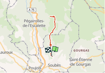

Length
11.3 km

Max alt
815 m

Uphill gradient
461 m
Km-Effort
17.6 km

Min alt
334 m

Downhill gradient
487 m
Boucle
Yes
Creation date :
2024-01-04 09:58:55.837
Updated on :
2024-03-09 09:38:48.595
4h51
Difficulty : Medium

FREE GPS app for hiking
 SityTrail
IGN / Geographical institutes
SityTrail Plus
The world is yours!
About
Trail Walking of 11.3 km to be discovered at Occitania, Hérault, Soubès. This trail is proposed by ericferon.
Positioning
Country:
France
Region :
Occitania
Department/Province :
Hérault
Municipality :
Soubès
Location:
Unknown
Start:(Dec)
Start:(UTM)
527634 ; 4846934 (31T) N.
Comments