


Orcieres

raygautier
User

Length
7.1 km

Max alt
2188 m

Uphill gradient
352 m
Km-Effort
12 km

Min alt
1864 m

Downhill gradient
391 m
Boucle
No
Creation date :
2024-03-19 09:02:30.0
Updated on :
2024-03-19 14:39:36.156

FREE GPS app for hiking
 SityTrail
IGN / Geographical institutes
SityTrail Plus
The world is yours!
About
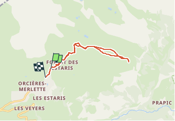
Trail of 7.1 km to be discovered at Provence-Alpes-Côte d'Azur, Hautes-Alpes, Orcières. This trail is proposed by raygautier.
Photos

Positioning
Country:
France
Region :
Provence-Alpes-Côte d'Azur
Department/Province :
Hautes-Alpes
Municipality :
Orcières
Location:
Unknown
Start:(Dec)
Start:(UTM)
288486 ; 4953273 (32T) N.
Comments