


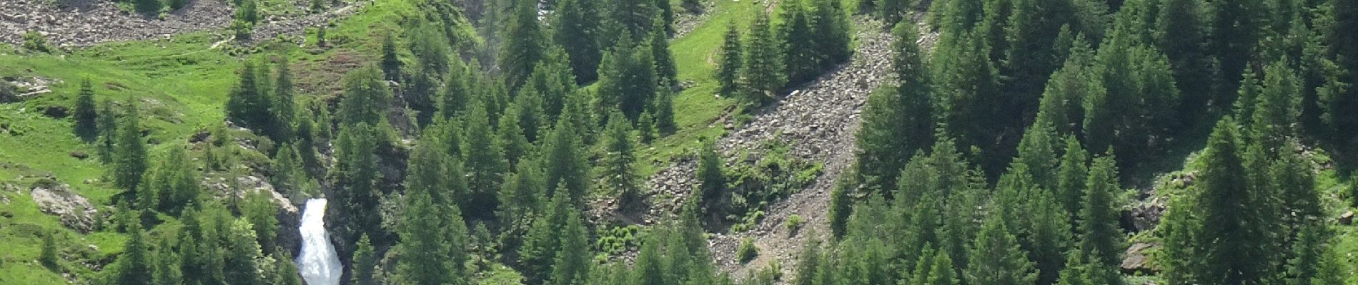
saut du laire

PhilB24
User
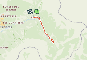

Length
9.3 km

Max alt
1890 m

Uphill gradient
385 m
Km-Effort
14.4 km

Min alt
1533 m

Downhill gradient
385 m
Boucle
Yes
Creation date :
2024-06-30 08:53:04.386
Updated on :
2024-07-01 19:27:53.281
2h25
Difficulty : Medium

FREE GPS app for hiking
 SityTrail
IGN / Geographical institutes
SityTrail Plus
The world is yours!
About
Trail Walking of 9.3 km to be discovered at Provence-Alpes-Côte d'Azur, Hautes-Alpes, Orcières. This trail is proposed by PhilB24.
Description
Au départ de Prapic, sentier sans difficulté mais belles ambiances. Au retour, arrêt à la Jabiore pour déguster la tarte aux myrtilles maison.
Photos


Positioning
Country:
France
Region :
Provence-Alpes-Côte d'Azur
Department/Province :
Hautes-Alpes
Municipality :
Orcières
Location:
Unknown
Start:(Dec)
Start:(UTM)
291299 ; 4952294 (32T) N.
Comments