


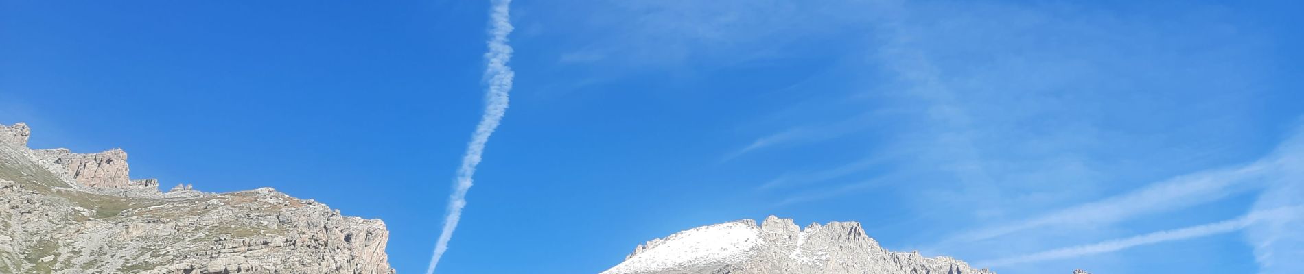
refuge de chambeyron

thomas1986
User
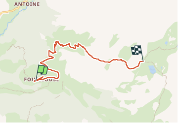

Length
7.1 km

Max alt
2629 m

Uphill gradient
783 m
Km-Effort
15.1 km

Min alt
1874 m

Downhill gradient
56 m
Boucle
No
Creation date :
2024-09-06 06:21:58.621
Updated on :
2024-09-06 16:06:47.929
2h38
Difficulty : Difficult

FREE GPS app for hiking
 SityTrail
IGN / Geographical institutes
SityTrail Plus
The world is yours!
About
Trail Walking of 7.1 km to be discovered at Provence-Alpes-Côte d'Azur, Alpes-de-Haute-Provence, Saint-Paul-sur-Ubaye. This trail is proposed by thomas1986.
Photos


Positioning
Country:
France
Region :
Provence-Alpes-Côte d'Azur
Department/Province :
Alpes-de-Haute-Provence
Municipality :
Saint-Paul-sur-Ubaye
Location:
Unknown
Start:(Dec)
Start:(UTM)
325056 ; 4932561 (32T) N.
Comments