


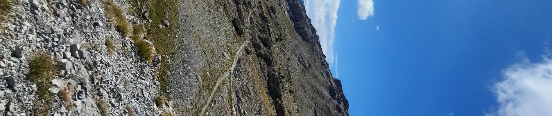
col de la gypiere

thomas1986
User
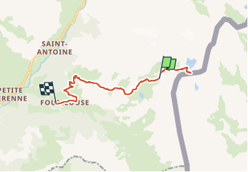

Length
10.9 km

Max alt
2923 m

Uphill gradient
165 m
Km-Effort
16.2 km

Min alt
1861 m

Downhill gradient
1089 m
Boucle
No
Creation date :
2024-09-06 11:13:54.938
Updated on :
2024-09-06 16:06:53.699
3h27
Difficulty : Difficult

FREE GPS app for hiking
 SityTrail
IGN / Geographical institutes
SityTrail Plus
The world is yours!
About
Trail Walking of 10.9 km to be discovered at Provence-Alpes-Côte d'Azur, Alpes-de-Haute-Provence, Saint-Paul-sur-Ubaye. This trail is proposed by thomas1986.
Photos


21 photos in total. Please click on a photo to see them all in the gallery.
Positioning
Country:
France
Region :
Provence-Alpes-Côte d'Azur
Department/Province :
Alpes-de-Haute-Provence
Municipality :
Saint-Paul-sur-Ubaye
Location:
Unknown
Start:(Dec)
Start:(UTM)
328964 ; 4933426 (32T) N.
Comments