


Tour de la Font Sancte - Partie 3

pasq65
User

Length
13.3 km

Max alt
2696 m

Uphill gradient
839 m
Km-Effort
25 km

Min alt
1633 m

Downhill gradient
1109 m
Boucle
No
Creation date :
2025-07-22 21:06:52.838
Updated on :
2025-07-22 21:21:34.802
5h45
Difficulty : Very difficult

FREE GPS app for hiking
 SityTrail
IGN / Geographical institutes
SityTrail Plus
The world is yours!
About
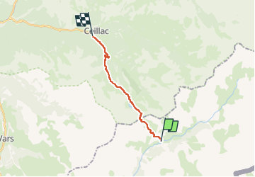
Trail Walking of 13.3 km to be discovered at Provence-Alpes-Côte d'Azur, Alpes-de-Haute-Provence, Saint-Paul-sur-Ubaye. This trail is proposed by pasq65.
Positioning
Country:
France
Region :
Provence-Alpes-Côte d'Azur
Department/Province :
Alpes-de-Haute-Provence
Municipality :
Saint-Paul-sur-Ubaye
Location:
Unknown
Start:(Dec)
Start:(UTM)
328679 ; 4939907 (32T) N.
Comments