Trail Walking Err - d'Err à Bolquère - Photo
 gberger
gberger

User

© OpenStreetMap contributors
Length
Length
12.9 km
Max alt
Max alt
1629 m
Uphill gradient
Uphill gradient
487 m
Km-Effort
Km-Effort  
18.5 km
Min alt
Min alt
1351 m
Downhill gradient
Downhill gradient
224 m
Boucle
Boucle
No
Creation date :
2015-09-20 00:00:00.0
Updated on :
2015-09-20 00:00:00.0

(0 Reviews)

Walking
Walking
4h10
Difficulty : Easy

Scan this QR Code to open this trail in the SityTrail application

FREE GPS app for hiking

Logo SityTrail SityTrail

IGN / Geographical institutes

Download SityTrail from the App Store Download SityTrail from Google Play

Logo SityTrail SityTrail World

The world is yours!

Download SityTrail from the App Store Download SityTrail from Google Play Download SityTrail on Huawei AppGallery

About

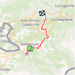
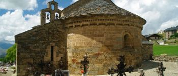
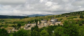
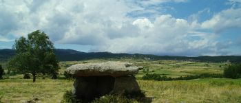
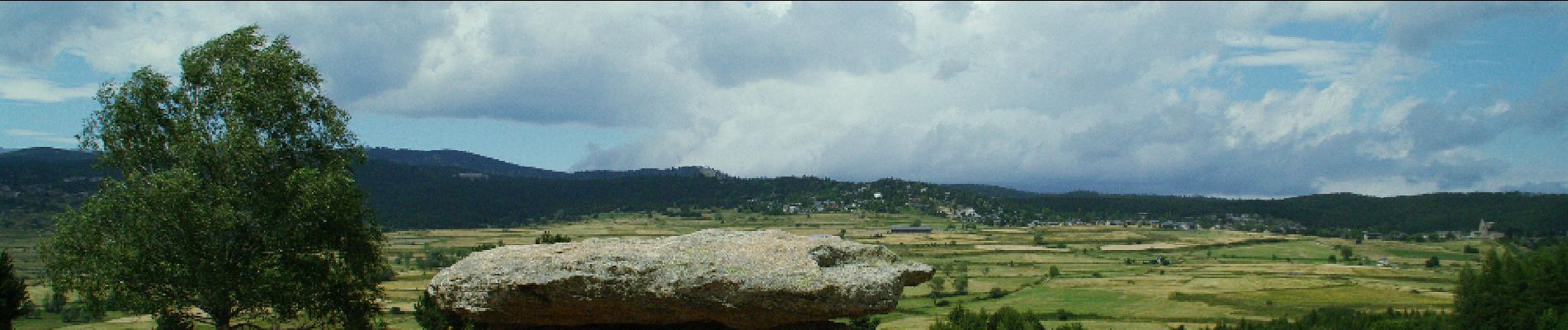
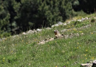
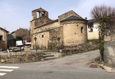
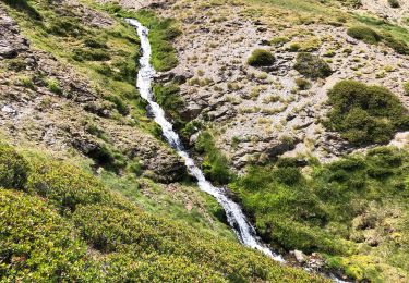
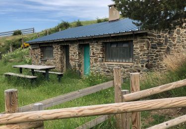
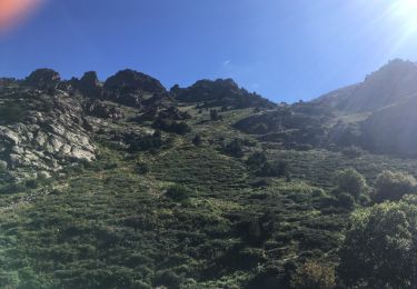
Trail Walking of 12.9 km to be discovered at Occitania, Pyrénées-Orientales, Err. This trail is proposed by gberger.

Description

Une randonnée sur le plateau de Cerdagne à combiner avec un aller ou un retour par le train jaune, de Bolquère à Err.

Elevation profile

Photos

Points of interest

Point of interest Saillagouse - Vedrinyans - Photo
gberger
SAILLAGOUSE 
Point of interest Saillagouse - Chapelle de Vedrinyans - Photo
gberger
Point of interest Saillagouse - Sallagouse - Photo
gberger
SAILLAGOUSE 
Point of interest Llo - Llo - Photo
gberger
LLO 
Point of interest Eyne - Eyne - Photo
gberger
EYNE 
Point of interest Eyne - Dolmen - Photo
gberger
EYNE 

Positioning

Country:
France
Region :
Occitania
Department/Province :
Pyrénées-Orientales
Municipality :
Err
Location:
Unknown
Start:(UTM)
420398 ; 4699032 (31T) N.

Trails nearby

Trail Walking Nahuja - boucle de Nahuja - Photo
Walking
crijack

Walking

Medium
(1)
Nahuja, Occitania, Pyrénées-Orientales, France
11.8 km | 18.2 km-effort
2h 44min
Yes
Trail Walking Eyne - Eyne,col de Nuria,pic d'Eyne,Torre d'Eyne,Eyne. - Photo
Walking
Machaon6

Walking

Very difficult
(1)
Eyne, Occitania, Pyrénées-Orientales, France
24 km | 43 km-effort
8h 44min
Yes
Trail Walking Eyne - Vallée d'Eyne - Photo
Walking
GUIDE
nadinebondoux

Walking

Medium
Eyne, Occitania, Pyrénées-Orientales, France
10.7 km | 17.6 km-effort
4h 40min
Yes
Trail Walking Eyne - eyne - Photo
Walking
gardelg

Walking

Medium
(2)
Eyne, Occitania, Pyrénées-Orientales, France
6.2 km | 8.2 km-effort
2h 1min
Yes
Trail Walking Eyne - La vallée d'Eyne - Photo
Walking
suresnois

Walking

Difficult
Eyne, Occitania, Pyrénées-Orientales, France
11.2 km | 18 km-effort
7h 8min
Yes
Trail Walking Estavar - 20220328 Estavar-Tartassonne(?) - Photo
Walking
ThonyM

Walking

Medium
Estavar, Occitania, Pyrénées-Orientales, France
14.8 km | 22 km-effort
3h 16min
Yes
Trail Walking Eyne - 20210722 vallée d’Eyne-Pic de Nuria et Finestrelle - Photo
Walking
ThonyM

Walking

Difficult
Eyne, Occitania, Pyrénées-Orientales, France
21 km | 37 km-effort
5h 56min
Yes
Trail Walking Saillagouse - 20210627 à partir de Saillagouse  - Photo
Walking
ThonyM

Walking

Medium
(1)
Saillagouse, Occitania, Pyrénées-Orientales, France
16.2 km | 26 km-effort
3h 47min
Yes
Trail Walking Eyne - valle´e d'Eyne - Photo
Walking
altaya

Walking

Easy
(1)
Eyne, Occitania, Pyrénées-Orientales, France
13.7 km | 23 km-effort
4h 17min
Yes


Close
My subscriptions