![](/images/other/stat-length.png)
![Trail Walking Beauchastel - Beauchastel. / Pierre Gourde - Photo](https://media.geolcdn.com/t/1900/400/ext.pjpeg?maxdim=2&url=https%3A%2F%2Fservices.sitytrail.com%2FGeolivesWS%2FDownloadMedia.ashx%3FTrailID%3D500378%26Media%3Dfix__20151206162513.jpg)
Beauchastel. / Pierre Gourde
patchil
User
![Length](/images/other/stat-length.png)
![Max alt](https://static1.geolcdn.com/siteimages/upload/files/1508320355ic_sort_altitude_max_24dp.png)
![Uphill gradient](https://static1.geolcdn.com/siteimages/upload/files/1508320355ic_sort_den_pos_24dp.png)
![Km-Effort](/images/other/stat-length.png)
![Min alt](https://static1.geolcdn.com/siteimages/upload/files/1508320355ic_sort_altitude_min_24dp.png)
![Downhill gradient](https://static1.geolcdn.com/siteimages/upload/files/1508320355ic_sort_den_neg_24dp.png)
![Boucle](https://static1.geolcdn.com/siteimages/upload/files/16400158638029165_repeat_loop_refresh_sync_direction_icon.png)
![Walking](https://static1.geolcdn.com/sitytour/trail-icons/101.png)
6h40
Difficulty : Medium
![Scan this QR Code to open this trail in the SityTrail application](https://capi.geolives.com/qq0zvz2zws4bq2lad0pu/sitytour/trails/500378/qr.png?size=200)
FREE GPS app for hiking
About
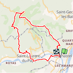
Trail Walking of 21 km to be discovered at Auvergne-Rhône-Alpes, Ardèche, Beauchastel. This trail is proposed by patchil.
Description
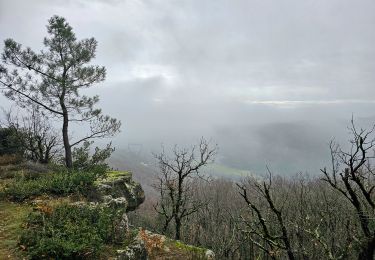
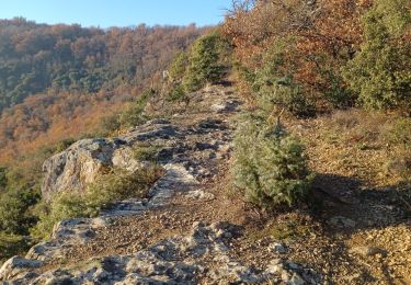
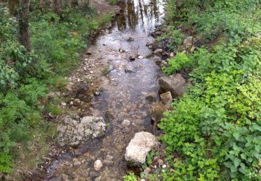
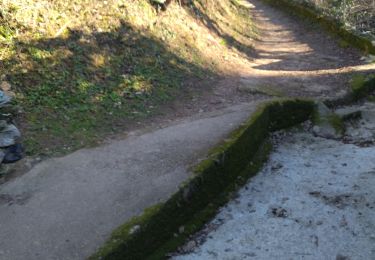
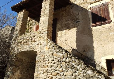
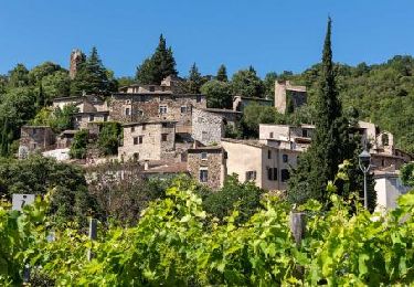
Le démarrage se fait sous le pont de Beauchastel. Suivre la rivière en direction de St Laurent du Pape et traverser les péchers jusqu'à rejoindre l'ancienne voix ferré . Arrivée au Village de St Laurent du Pape aller jusuq'à la Poste et remonter au camping où de suite après vers la gauche vous trouverez un petitt sentier en sous bois sympatique qui vous amène à un petit ruisseau. Traverser le hameau et suivre l'itinéraire par un chemin caillouteux non balisé qui rejoins le GR 42 . Là une belle montée d'une heure et demi pour arriver au Château de Pierre Gourde. Il y a souvent du vent là haut. La descente se fait progressivement mais attention nous avons fais une toute petite erreur vers les Serres de Girbaud car il faut prendre le sentier vers la droite et non vers la gauche mais il y aura encore une petite grimpette juste après le col de Meran à 547 m. Compter deux bonnes heures pour rejoindre Beauchastel par les crêtes par un grand sentier . A un carrefour Goutaillé vous avez le choix de suivre mon itinéraire ou de suivre un autre chemin par la Beraude mais il y une heure de plus au compteur en plus. L'arrivée se fait par un dernier chemin un peu raide durant 1/2 heure qui finit en haut du vieux village de Beauchastel. Je vous recommande vivement de passer par les petits escaliers qui passent par les toutes petites ruelles qui sont magnifiques. Après le village passer sous un petit passage qui vous fera longer la rivière puis le grand pont de Beauchastel.
Positioning
Comments
Trails nearby
![Trail Walking La Voulte-sur-Rhône - La Voulte Via-Rhôna 7KM - Photo](https://media.geolcdn.com/t/375/260/ext.jpg?maxdim=2&url=https%3A%2F%2Fmedia.geolcdn.com%2Ff%2F620eea2b-7c65-44be-a1eb-b1fcfc74c039.jpg)
![Walking Walking](https://static1.geolcdn.com/sitytour/trail-icons/101.png)
Walking
![](/images/other/stat-length.png)
![](https://static1.geolcdn.com/siteimages/upload/files/16400158638029165_repeat_loop_refresh_sync_direction_icon.png)
![Trail Walking La Voulte-sur-Rhône - La Voulte ViaRhona 6,5km - Photo](https://media.geolcdn.com/t/375/260/ext.jpg?maxdim=2&url=https%3A%2F%2Fmedia.geolcdn.com%2Ff%2F9614651f-4007-44ca-9c3c-97a6e4ce7270.jpg)
![Walking Walking](https://static1.geolcdn.com/sitytour/trail-icons/101.png)
Walking
![](/images/other/stat-length.png)
![](https://static1.geolcdn.com/siteimages/upload/files/16400158638029165_repeat_loop_refresh_sync_direction_icon.png)
![Trail Walking Saint-Laurent-du-Pape - Pierre gourde TeD Christian - Photo](https://media.geolcdn.com/t/375/260/ext.jpg?maxdim=2&url=https%3A%2F%2Fstatic1.geolcdn.com%2Fsiteimages%2Fupload%2Ffiles%2F1553511878bg_sport_marche.png)
![Walking Walking](https://static1.geolcdn.com/sitytour/trail-icons/101.png)
Walking
![](/images/other/stat-length.png)
![](https://static1.geolcdn.com/siteimages/upload/files/16400158638029165_repeat_loop_refresh_sync_direction_icon.png)
![Trail Walking Saint-Georges-les-Bains - Saint Georges les Bains - Photo](https://media.geolcdn.com/t/375/260/ext.jpg?maxdim=2&url=https%3A%2F%2Fmedia.geolcdn.com%2Ff%2Fe93486d4-d5f4-4b3e-8536-d4298013ea4d.jpg)
![Walking Walking](https://static1.geolcdn.com/sitytour/trail-icons/101.png)
Walking
![](/images/other/stat-length.png)
![](https://static1.geolcdn.com/siteimages/upload/files/16400158638029165_repeat_loop_refresh_sync_direction_icon.png)
![Trail Walking Saint-Georges-les-Bains - col de Rotison - Photo](https://media.geolcdn.com/t/375/260/ext.jpg?maxdim=2&url=https%3A%2F%2Fmedia.geolcdn.com%2Ff%2F8c3d1009-c72f-4ec6-bf61-7a2fde476dc2.jpg)
![Walking Walking](https://static1.geolcdn.com/sitytour/trail-icons/101.png)
Walking
![](/images/other/stat-length.png)
![](https://static1.geolcdn.com/siteimages/upload/files/16400158638029165_repeat_loop_refresh_sync_direction_icon.png)
![Trail Walking Saint-Laurent-du-Pape - 07 st Laurent du pape P Gourde 060521 - Photo](https://media.geolcdn.com/t/375/260/ext.jpg?maxdim=2&url=https%3A%2F%2Fmedia.geolcdn.com%2Ff%2Fab7e67df-3108-4810-a988-7cdece498721.jpg)
![Walking Walking](https://static1.geolcdn.com/sitytour/trail-icons/101.png)
Walking
![](/images/other/stat-length.png)
![](https://static1.geolcdn.com/siteimages/upload/files/16400158638029165_repeat_loop_refresh_sync_direction_icon.png)
![Trail Walking Saint-Laurent-du-Pape - 07 st Laurent du pape zel - Photo](https://media.geolcdn.com/t/375/260/ext.jpg?maxdim=2&url=https%3A%2F%2Fmedia.geolcdn.com%2Ff%2Fe32d23cf-7d2c-48ae-91cd-162887108580.jpg)
![Walking Walking](https://static1.geolcdn.com/sitytour/trail-icons/101.png)
Walking
![](/images/other/stat-length.png)
![](https://static1.geolcdn.com/siteimages/upload/files/16400158638029165_repeat_loop_refresh_sync_direction_icon.png)
![Trail Walking Saint-Laurent-du-Pape - St Laurent du Pape - Photo](https://media.geolcdn.com/t/375/260/ext.jpg?maxdim=2&url=https%3A%2F%2Fmedia.geolcdn.com%2Ff%2Fe4200a56-11be-413f-877b-2deda99a35b2.jpg)
![Walking Walking](https://static1.geolcdn.com/sitytour/trail-icons/101.png)
Walking
![](/images/other/stat-length.png)
![](https://static1.geolcdn.com/siteimages/upload/files/16400158638029165_repeat_loop_refresh_sync_direction_icon.png)
![Trail Walking Beauchastel - 2022-06-25_20h37m57_Beauchastel 16,5km.gpx (1).xml - Photo](https://media.geolcdn.com/t/375/260/ext.jpg?maxdim=2&url=https%3A%2F%2Fmedia.geolcdn.com%2Ff%2Fc478205d-33f4-4e99-b83b-07be3d25d520.jpg)
![Walking Walking](https://static1.geolcdn.com/sitytour/trail-icons/101.png)
Walking
![](/images/other/stat-length.png)
![](https://static1.geolcdn.com/siteimages/upload/files/16400158638029165_repeat_loop_refresh_sync_direction_icon.png)