Trail Walking Sers - Sers - Photo
 dorcier
dorcier

User

© OpenStreetMap contributors
Length
Length
10.7 km
Max alt
Max alt
183 m
Uphill gradient
Uphill gradient
200 m
Km-Effort
Km-Effort  
13.3 km
Min alt
Min alt
96 m
Downhill gradient
Downhill gradient
188 m
Boucle
Boucle
Yes
Creation date :
2016-05-20 00:00:00.0
Updated on :
2016-05-20 00:00:00.0

(1 Reviews)

Walking
Walking
3h19
Difficulty : Easy

Scan this QR Code to open this trail in the SityTrail application

FREE GPS app for hiking

Logo SityTrail SityTrail

IGN / Geographical institutes

Download SityTrail from the App Store Download SityTrail from Google Play

Logo SityTrail SityTrail World

The world is yours!

Download SityTrail from the App Store Download SityTrail from Google Play Download SityTrail on Huawei AppGallery

About

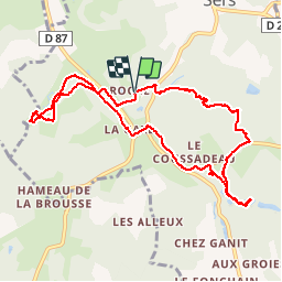
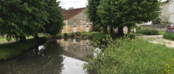
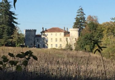
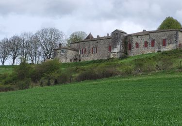
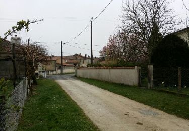
Trail Walking of 10.7 km to be discovered at New Aquitaine, Charente, Sers. This trail is proposed by dorcier.

Description

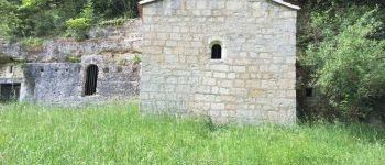
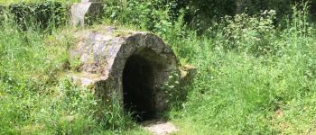
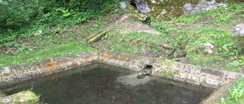
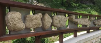
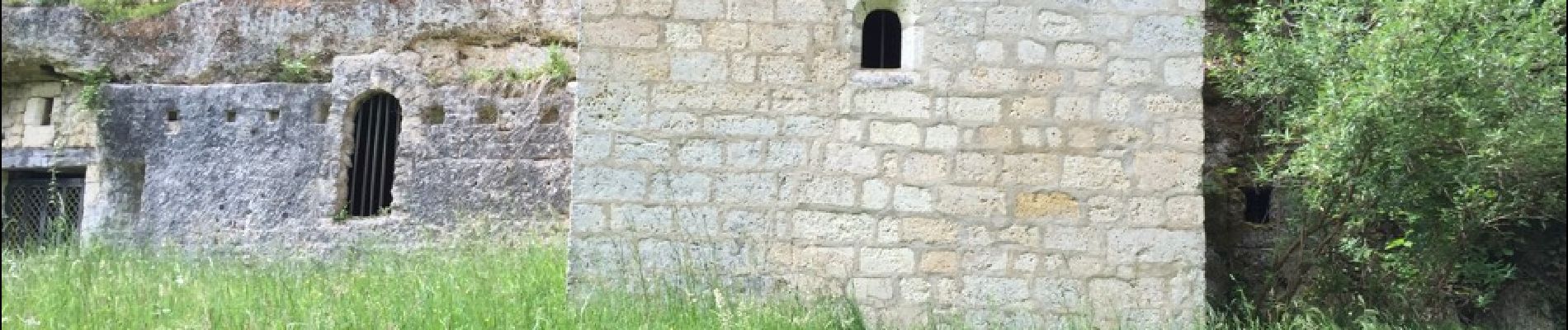
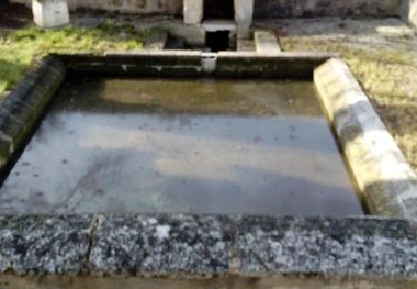
ce circuit facile fait le tour des sites remarquables de la commune de Sers. Sité mérovingien e Belleveau avec son ermitage et sa fontaine miraculeuse. Site préhistorique du Roc de Sers avec sa remarquable fresque sculptée dans le roc.

Elevation profile

Photos

Points of interest

Point of interest Sers - ermitage - Photo
dorcier
SERS 
Point of interest Sers - fontaine - Photo
dorcier
SERS 
Point of interest Sers - lampisterie - Photo
dorcier
Point of interest Sers - Fonderie - Photo
dorcier
SERS 
Point of interest Sers - Lavoir - Photo
dorcier
SERS 
Point of interest Sers - Roc de Sers - Photo
dorcier

Positioning

Country:
France
Region :
New Aquitaine
Department/Province :
Charente
Municipality :
Sers
Location:
Unknown
Start:(UTM)
290233 ; 5051585 (31T) N.

Comments

Please log in to post a review or rate the element


Excellent produit pour une randonnée sans soucis


Trails nearby

Trail Walking Dirac - Les lavoirs de Dirac - Photo
Walking
dorcier

Walking

Easy
Dirac, New Aquitaine, Charente, France
7.4 km | 9 km-effort
2h 5min
Yes
Trail Walking Garat - garat1912 - Photo
Walking
dededavid

Walking

Medium
Garat, New Aquitaine, Charente, France
5.9 km | 7.3 km-effort
1h 43min
Yes
Trail Walking Dignac - cloula1104 - Photo
Walking
dededavid

Walking

Medium
Dignac, New Aquitaine, Charente, France
7 km | 8.6 km-effort
2h 43min
Yes
Trail Walking Dignac - dignac_ouest G-16417318 - Photo
Walking
Gege Lolo

Walking

Difficult
Dignac, New Aquitaine, Charente, France
11.3 km | 13.4 km-effort
3h 2min
Yes
Trail Walking Dirac - Dirac - Photo
Walking
Gege Lolo

Walking

Medium
Dirac, New Aquitaine, Charente, France
9.9 km | 11.8 km-effort
2h 41min
Yes
Trail Walking Sers - qers - Photo
Walking
thierry16

Walking

Easy
Sers, New Aquitaine, Charente, France
4.1 km | 5.8 km-effort
1h 4min
No
Trail Mountain bike Dirac - VTT DIRAC 16 - Photo
Mountain bike
topolino

Mountain bike

Difficult
Dirac, New Aquitaine, Charente, France
48 km | 60 km-effort
Unknown
Yes
Trail Walking Dignac -  Sentier  de Cloulas - Photo
Walking
Patriziu

Walking

Easy
Dignac, New Aquitaine, Charente, France
10.3 km | 12.9 km-effort
2h 18min
Yes
Trail Walking Dignac - Entre Dignac et Cloulas  (circuit jaune ) - Photo
Walking
alainjoseph6

Walking

Easy
Dignac, New Aquitaine, Charente, France
9.8 km | 12 km-effort
2h 59min
Yes


Close
My subscriptions