


Étape 3 - du lac long à maljasset - 04 août 2016

morganee
User
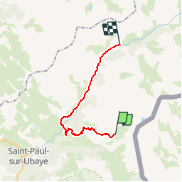

Length
16.9 km

Max alt
2629 m

Uphill gradient
409 m
Km-Effort
25 km

Min alt
1590 m

Downhill gradient
1110 m
Boucle
No
Creation date :
2019-07-19 19:06:01.376
Updated on :
2019-07-19 19:06:01.457
4h12
Difficulty : Difficult

FREE GPS app for hiking
 SityTrail
IGN / Geographical institutes
SityTrail Plus
The world is yours!
About
Trail Walking of 16.9 km to be discovered at Provence-Alpes-Côte d'Azur, Alpes-de-Haute-Provence, Saint-Paul-sur-Ubaye. This trail is proposed by morganee.
Description
Fin longue et pénible le long de la route
Positioning
Country:
France
Region :
Provence-Alpes-Côte d'Azur
Department/Province :
Alpes-de-Haute-Provence
Municipality :
Saint-Paul-sur-Ubaye
Location:
Unknown
Start:(Dec)
Start:(UTM)
328046 ; 4933020 (32T) N.
Comments