


Étape 1 - de maljasset aux lacs de marinet - 02 août 2016

morganee
User
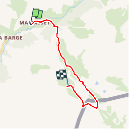

Length
10.7 km

Max alt
2783 m

Uphill gradient
889 m
Km-Effort
20 km

Min alt
1902 m

Downhill gradient
260 m
Boucle
No
Creation date :
2019-07-19 19:06:00.374
Updated on :
2019-07-19 19:06:00.477
4h30
Difficulty : Medium

FREE GPS app for hiking
 SityTrail
IGN / Geographical institutes
SityTrail Plus
The world is yours!
About
Trail Walking of 10.7 km to be discovered at Provence-Alpes-Côte d'Azur, Alpes-de-Haute-Provence, Saint-Paul-sur-Ubaye. This trail is proposed by morganee.
Description
3 jours autour du Pic de Chambeyron
Positioning
Country:
France
Region :
Provence-Alpes-Côte d'Azur
Department/Province :
Alpes-de-Haute-Provence
Municipality :
Saint-Paul-sur-Ubaye
Location:
Unknown
Start:(Dec)
Start:(UTM)
328585 ; 4939907 (32T) N.
Comments