Trail Walking Rüttenen - Circuit Rüttenen - Soleure 09.10.16 - Photo

Circuit Rüttenen - Soleure 09.10.16

 duamerg
duamerg

User

© OpenStreetMap contributors
Length
Length
9.7 km
Max alt
Max alt
573 m
Uphill gradient
Uphill gradient
227 m
Km-Effort
Km-Effort  
12.7 km
Min alt
Min alt
423 m
Downhill gradient
Downhill gradient
227 m
Boucle
Boucle
Yes
Creation date :
2016-10-28 00:00:00.0
Updated on :
2020-01-30 13:56:36.936

(0 Reviews)

Walking
Walking
2h44
Difficulty : Easy

Scan this QR Code to open this trail in the SityTrail application

FREE GPS app for hiking

Logo SityTrail SityTrail

IGN / Geographical institutes

Download SityTrail from the App Store Download SityTrail from Google Play

Logo SityTrail SityTrail World

The world is yours!

Download SityTrail from the App Store Download SityTrail from Google Play Download SityTrail on Huawei AppGallery

About

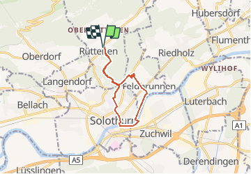
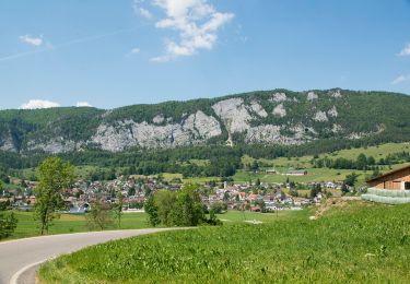
Trail Walking of 9.7 km to be discovered at Solothurn, Bezirk Lebern, Rüttenen. This trail is proposed by duamerg.

Description

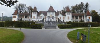
Splendeur baroque aux portes de Soleure.
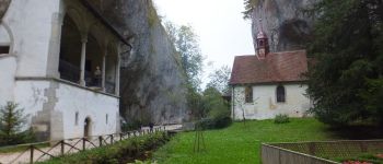
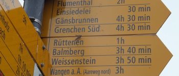
Places de parc à Rüttenen. Suivre les panneaux pour Einsiedelei à l'entrée de la gorge.
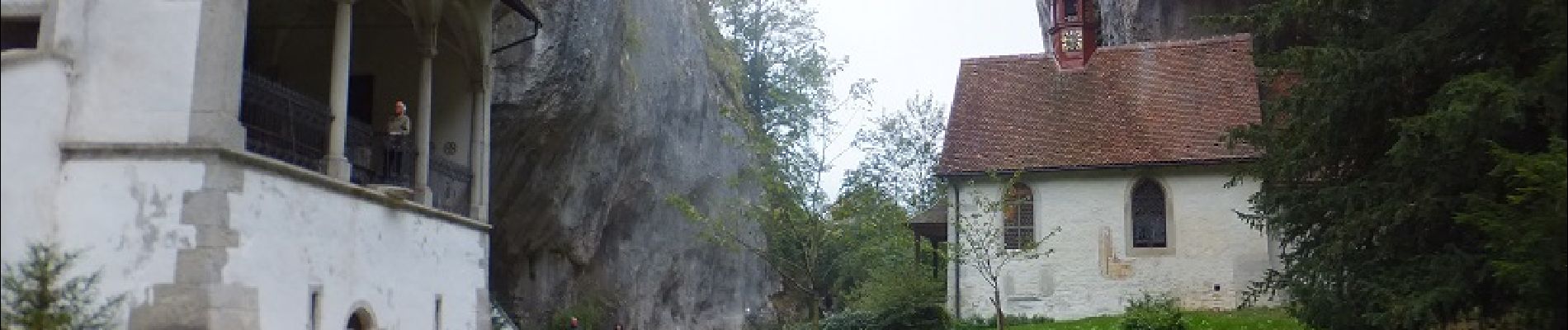
Deux églises dont une magnifiquement décorée se trouvent à cet endroit avec encore un ermite qui y habite.
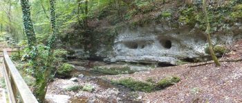
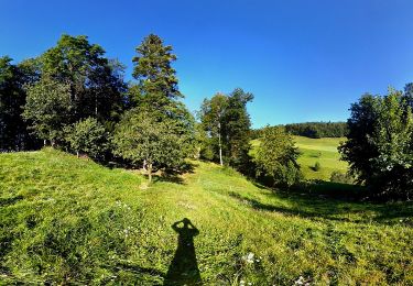
Suivre le bucolique chemin longeant le Verenabach (gorges de Sainte-Vérène).
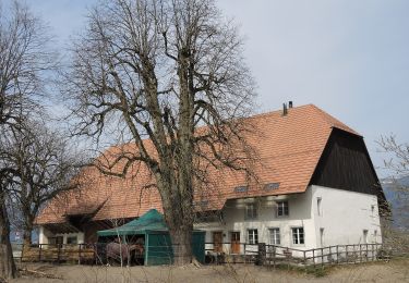
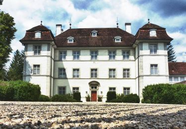
A la sortie prendre à gauche et suivre la route qui vous amène au château de Waldegg véritable oeuvre baroque avec de beaux jardins.
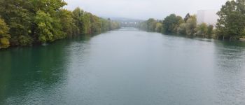
Longer la longue allée de tilleuls pour retrouver le chemin pédestre qui vous amène par le bord du lac jusqu'à Soleure.
Cette petite ville mérite une visite (pas inclus dans le temps de marche) et tout particulièrement son église.
Par la ville et de petites rues on rejoint à nouveau la gorge pour retrouver notre point de départ.
Très jolie promenade agrémentée de bancs, restaurants.
Convient aux familles.

Elevation profile

Photos

Points of interest

Point of interest Rüttenen - gorge - Photo
duamerg
RÜTTENEN 
Point of interest Feldbrunnen-St. Niklaus - château  de Waldegg - Photo
duamerg
FELDBRUNNEN-ST. NIKLAUS 
Point of interest Solothurn - les bords de l'Aar - Photo
duamerg
Point of interest Solothurn - Soleure - Photo
duamerg
SOLOTHURN 

Positioning

Country:
Switzerland
Region :
Solothurn
Department/Province :
Bezirk Lebern
Municipality :
Rüttenen
Location:
Unknown
Start:(UTM)
389002 ; 5232067 (32T) N.

Trails nearby

Trail On foot Solothurn - Solothurn HB - Derendingen - Photo
On foot
PRO

On foot

Easy
Solothurn, Solothurn, Bezirk Solothurn, Switzerland
4 km | 5.3 km-effort
1h 12min
No
Trail On foot Solothurn - Solothurn HB - Lohn Lüterkofen - Photo
On foot
PRO

On foot

Easy
Solothurn, Solothurn, Bezirk Solothurn, Switzerland
5.6 km | 7.5 km-effort
1h 42min
No
Trail On foot Welschenrohr-Gänsbrunnen - Weissenstein – Passwang Weg - Photo
On foot
PRO

On foot

Medium
Welschenrohr-Gänsbrunnen, Solothurn, Bezirk Thal, Switzerland
16.8 km | 26 km-effort
5h 57min
No
Trail On foot Balm bei Günsberg - Balmberg Passhöhe - Welschenrohr - Photo
On foot
PRO

On foot

Easy
Balm bei Günsberg, Solothurn, Bezirk Lebern, Switzerland
3.6 km | 5.1 km-effort
1h 9min
No
Trail On foot Solothurn - Aareuferweg - Photo
On foot
PRO

On foot

Easy
Solothurn, Solothurn, Bezirk Solothurn, Switzerland
4.3 km | 5 km-effort
1h 8min
No
Trail On foot Oberdorf (SO) - Planetenweg - Photo
On foot
PRO

On foot

Easy
Oberdorf (SO), Solothurn, Bezirk Lebern, Switzerland
9.9 km | 15.2 km-effort
3h 27min
No
Trail Walking Solothurn - wa36 - Photo
Walking
GUIDE+

Walking

Very easy
Solothurn, Solothurn, Bezirk Solothurn, Switzerland
17.7 km | 23 km-effort
7h 33min
No
Trail Walking Welschenrohr-Gänsbrunnen - w09_thal1 - Photo
Walking
GUIDE+

Walking

Very easy
Welschenrohr-Gänsbrunnen, Solothurn, Bezirk Thal, Switzerland
15 km | 26 km-effort
4h 35min
No
Trail Other activity Balm bei Günsberg - Balmberg - Wolfisberg - Photo
Other activity
steger12

Other activity

Very easy
Balm bei Günsberg, Solothurn, Bezirk Lebern, Switzerland
11 km | 15.7 km-effort
Unknown
No


Close
My subscriptions