


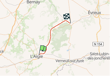
Haute - Normandie - Ligne 398 - Saint-Martin-d'Écublei - Conches

mich54
User


5m
Difficulty : Unknown

FREE GPS app for hiking
 SityTrail
IGN / Geographical institutes
SityTrail Plus
The world is yours!
About
Trail Other activity of 36 km to be discovered at Normandy, Orne, Saint-Sulpice-sur-Risle. This trail is proposed by mich54.
Description
La ligne de Saint-Martin-d'Écublei à Conches est une ancienne ligne de chemin de fer française qui reliait la commune de Saint-Martin-d'Écublei à proximité de L'Aigle à celle de Conches-en-Ouche, dans les départements de l'Orne et de l'Eure, régions Basse-Normandie et Haute-Normandie.
Elle constituait la ligne 398 0001 du Réseau ferré national. Elle ferme au trafic voyageurs le 31 mai 1970 lors de la mise en place du service d'été.(Source Wikipédia)
Positioning
Comments