


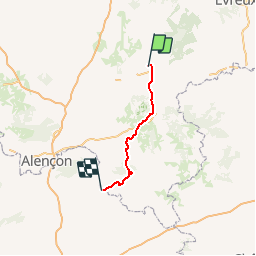
Basse Normandie - Ligne 00G - L'Aigle - La Hutte-Coulombiers (Section de L'Aigle à St Rémy-des-Monts)

mich54
User


5m
Difficulty : Unknown

FREE GPS app for hiking
 SityTrail
IGN / Geographical institutes
SityTrail Plus
The world is yours!
About
Trail Other activity of 72 km to be discovered at Normandy, Orne, Saint-Sulpice-sur-Risle. This trail is proposed by mich54.
Description
La ligne ferroviaire de L'Aigle (Laigle) à La Hutte-Coulombiers est une ancienne ligne de chemin de fer française, se trouvant dans le département de l'Orne et de la Sarthe et les régions Basse-Normandie et Pays de la Loire.La gare, tout comme la commune, s'écrivait Laigle jusqu'en 1961.(Source Wikipédia)
Positioning
Comments