


fontaine la soret

werth
User
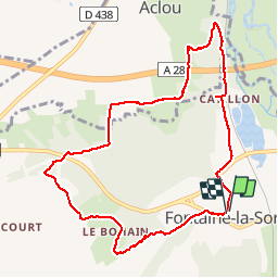

Length
9.2 km

Max alt
152 m

Uphill gradient
150 m
Km-Effort
11.2 km

Min alt
67 m

Downhill gradient
153 m
Boucle
Yes
Creation date :
2018-04-17 18:39:27.019
Updated on :
2018-04-17 18:39:27.019
2h17
Difficulty : Easy

FREE GPS app for hiking
 SityTrail
IGN / Geographical institutes
SityTrail Plus
The world is yours!
About
Trail Walking of 9.2 km to be discovered at Normandy, Eure, Nassandres sur Risle. This trail is proposed by werth.
Description
bien mais pas balisé
Positioning
Country:
France
Region :
Normandy
Department/Province :
Eure
Municipality :
Nassandres sur Risle
Location:
Unknown
Start:(Dec)
Start:(UTM)
333394 ; 5446487 (31U) N.
Comments